
Soils of the Werribee Research Farm
Soils Pit Information | Geology of the Research Farm Area | Research Farm History | Soil Overview
The first soils project on the research farm was a chemical survey carried out during 1915-18. Site locations were marked onto a surface colour map of the farm on the western side of the outfall sewer. Analyses carried out were for nitrogen, phosphoric acid (P2O5), potash (K2O), lime (CaO), magnesia (MgO), chloride and pH.
F. Penman was concerned with soil changes under irrigated pasture and published his work under that title in the Journal of Agriculture, Victoria in 1940. In 1953, V. Grasmanis carried out a soil survey and produced a map compiled from a field study of soil profiles. Profiles were recorded at about 160 metre intervals or closer where the soil pattern appeared to make this necessary. He proposed nine soil units distributed between two major groups themselves separated on the basis of a presumed difference in parent material. J.K.M. Skene’s review of earlier work was prepared in the light of supplementary observations and the results of laboratory analyses. This review was made in connection with his contributions to the School of Irrigated Pastures and Fodder Crops (1954), the 1956-57 Guide Book to the State Research Farm and the Study Tours handbook for the Second Australian Conference in Soil Science (1957).
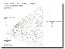
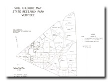
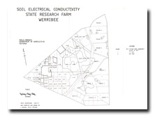
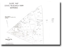
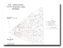
A more intense soil survey of the State Research Farm was undertaken by John Maher and John Martin in 1979. This survey was designed as a training survey for a new Cadet (John Maher) to the former Department of Agriculture. A grid survey was chosen at a density of one site per two hectares (i.e. a site every 150 metres) and mapping done at scale of 1:10 000. In all, some 300 soil profiles were examined. The report (available for download below) contains descriptions of the soil types (based on Northcote Factual Key classification) that occur across the Farm, as well as maps showing soil subdivisions, chloride, electrical conductivity and provisional land capability.
To view the information PDF requires the use of a PDF reader. This can be installed for free from the Adobe website (external link).
 | 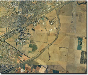 Aerial view over the former State Research Farm environs (December 2000). Only part of the original Research Farm now exists and is managed by the Department of Primary Industries (DPI). |
(PDF 592KB) |
Maps

© State of Victoria (Agriculture Victoria) 1996 - 2025.

This work, Victorian Resources Online, is licensed under a Creative Commons Attribution 4.0 licence. You are free to re-use the work under that licence, on the condition that you credit the State of Victoria (Agriculture Victoria) as author, indicate if changes were made and comply with the other licence terms.
The licence does not apply to ‘branding’ or some ‘images or photographs’ that may be owned by third parties. We ask you to seek prior approval to use images using the VRO feedback form. Access to higher quality images can also be provided on request.
This page was last updated on 23/11/2018.