SV1 - Brisbane Ranges - Fault Scarp, Alluvial Apron
|
This information has been developed from this publication:
|
| Location: | Staugton Vale - 620140. Shire of Ballan (western section) Shire of Bacchus Marsh (eastern section). Northern Brisbane Ranges. |  Brisbane Ranges - Fault Scarp, Alluvial Apron |
Access: | Thompson Road, Brisbane Road. | |
Ownership: | Crown land and private land. | |
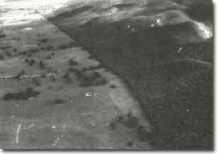
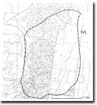
Site Description: | The sites include a clear example of the linear nature of the fault scarp, the west to east draining valleys, and the alluvial/colluvial apron at the base of the scarp. | |
Significance: | State. The Rowsley Fault is probably the most obvious example of a fault scarp in Victoria. It is the major structural and physiographic feature west of Melbourne and delineates the margin of the Werribee lava plain. The relationship between faulting, scarp formation, valley incision, and alluvial fan development is displayed with unusual clarity. The site provides an outstanding earth science teaching and research resource. | |
Management: | Class 2. Road and track development in the National Park should be designed to preserve the visual integrity of the escarpment. The areas of alluvial/colluvial apron should be reserved from residential subdivision or other forms of building development to allow display of the physiography of these deposits. In the long term, it would be desirable to include examples of the alluvial/colluvial apron in the Brisbane Ranges National Park. | |
 Site - SV1 |


