56. Somers - Beach Ridges and Bluff
|
This information has been developed from one or more of these publications:
|
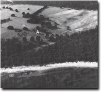
| Location: | Somers – 410484. One kilometre east of Somers. |  Bluff (A) and older beach ridges at the proximal end of the Sandy Point spit, Site 56 |
| Access: | South Beach Road and South Sea Road. | |
| Ownership: | Private land and Crown Land. | |
| Geomorphology: | The site includes the lower slopes of Western Hill which terminate as a coastal bluff. Seaward of the bluff are sets of low and regularly spaced sand beach ridges which converge towards the west. | |
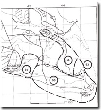
| Significance: | State. This site is continuous with Site 55 and forms part of the complex depositional system that comprises Sandy Point. This system is the major sand spit accumulation in the Westernport region and one of the largest on the Victorian coast. | |
| Management: | Class 2. Minimal disturbance to the sand ridge system is required to maintain the significance of the site. Further clearing of vegetation and levelling of the surface should be prohibited. | |
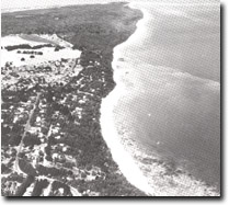
 The depositional complex of Sandy Point extending eastward from the bluff at Somers, Sites 53, 55 and 56. |


