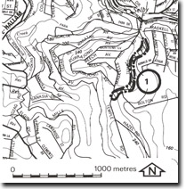
WP1. Selby-Lysterfield - Granodiorite Contact
|
This information has been developed from one or more of these publications:
|
| Location: | Lysterfield – 566018. Road cuttings on Maskells Hill Road and Temple Road one to two kilometres south of Selby. | |
Access: | Maskells Hill Road and Temple road. | |
Ownership: | Crown Land. | |
Geology/Geomorphology: | The roads traverse the contact zone between the Lysterfield Granodiorite and the Ferny Creek Rhyodacite (one of the main formations of the Mount Dandenong volcanics Group). There are exposures of granodiorite boulders and limited outcrop of metamorphosed (schistose) dacites, the metamorphism being related both to movements on the Selby Fault and to the intrusion of the granodiorite. | |
Significance: | Regional. This is the main exposure of the Dandenongs volcanic complex in the Westernport Bay catchment and a clear example of the metamorphic textures in these rocks near the Lysterfield Granodiorite. | |
Management: | Class 2. Exposures on existing and future road cuttings should be left clear and not be obscured by bank stabilisation works. | |
References: | Berger, A.R. (1961). Studies on dacite-granodiorite contact relationships in the Dandenong Ranges and Warburton areas, Vict. M.Sc. thesis, (unpub.) Geol. Dept., Univ. of Melb. Singleton (1973). | |


