53. Sandy Point - Salt Marsh and Relict Spit
|
This information has been developed from one or more of these publications:
|
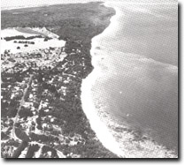
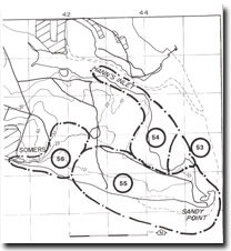
| Location: | Somers – 448484. One kilometre north-west of the recurved spit at Sandy Point. The area lies inside the RAN Flinders Naval Depot. |  The depositional complex of Sandy Point extending eastward from the bluff at Somers, Site 53, 55, 56. |
| Access: | The area is closed to the public and permission for entry must be obtained from the appropriate officer ate the Naval Depot. | |
| Ownership: | Commonwealth Government land (RAN Flinders Naval Depot.) | |
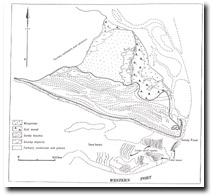
| Geomorphology: | A broad area of salt marsh has developed behind a mangrove fringe on the northern side of Sandy Point. Enclosed in the salt marsh and behind the mangrove fringe is a narrow recurving spit. Indicating an episode of sand transport into the mouth of Hand Inlet. | |
| Significance: | Regional. The spit illustrates a recent incursion of sand into the inlet and is of interest as an indicator of an earlier stage of development of the Sandy Point complex. | |
| Management: | Class 1. Physical disturbance of the spit system and the enclosing marsh and mangroves should be prohibited. | |
 Site 53, Sandy Point area |


