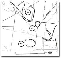
41. Pearcedale - Abandoned Tidal Meander
|
This information has been developed from one or more of these publications:
|
| Location: | Baxter – 443686. One kilometre south of Pearcedale. |  Site 41, old tidal meander |
| Access: | South Boundary Road. | |
| Ownership: | Private land. | |
| Geomorphology: | A broadly curving wide depression, the floor of which has been drained, is probably an abandoned tidal meander of an earlier Holocene extension of tideways of Watsons Inlet. | |
| Significance: | Regional. This is one of the best displayed palaeo-tidal features on the western side of Westernport Bay. | |
| Management: | Class 2. Extensive building construction or modification of the topography of the sire should not be permitted. | |


