PP72. Manmangur Creek - Mesozoic and Granite
|
This information has been developed from one or more of these publications:
|
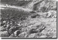
| Location: | 301698. 100 m south of Sunnyside Beach, Mornington. |  Site 72. Manmangur Creek. Raised platform, beach gravels in cliffs, Mesozoic below gravel beach |
Access: | Sunnyside Road. | |
Ownership/Managing Authority: | Crown land, Shire of Mornington. | |
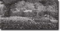
Site Description: | South of Manmangur Creek, the coast is backed by steep bluffs of the Mt Eliza Granodiorite. This rock is exposed only at the coast, as inland it is covered by weathered deposits and Tertiary sediments. The rock is strongly sheared with closely spaced fractures indicating faulting. A fault intersects the granite just south of the mouth of Manamangur Creek and the faulting has preserved a small block of Mesozoic (Early Cretaceous) sandstone which outcrops at low tide as part of the shore platform immediately in front of a granite cliff. The beach materials are granite gravels derived mainly from screes, weathered slope deposits and gravels from a former beach that lies on a shore platform 2 m above present high water mark. Parts of the old platform are being exhumed by present day erosion. Several small stack and reefs fringe the coast, some being remnant from higher sea levels. | |
Significance: | State. The Sunnyside area contains the only outcrops of Mesozoic rock in Port Phillip Bay. They represent the most easterly outcrop of the Mesozoic rocks of the Otway Basin. The site is a clear example of the influence of faulting in providing geological complexity. The beach is an example of a relatively ‘closed’ beach system with the coarse gravels not being moved by longshore drift or other wave currents. It is also an unusually clear example of a beach derived largely from quarrying of ancient deposits rather than directly from the rock that outcrops at the shore. The development of a shore platform in granitic rocks is unusual on the Victorian coast. The site is an extremely challenging site for geological and geomorphological interpretation. | |
Management Considerations: | Class 1. It is important to preserve the small Mesozoic outcrop near Manmangur Creek. No beach nourishment should be carried out and not structures built that would obscure the former platform and beach materials at the first small points south of the creek. Although steep, this is a relatively stable coastal slope and the natural profiles of slope, beach and platform should be maintained as examples of coastal bluff formation. | |
References: | Keble, R.A. (1950). The Sunklands of Port Phillip Bay and Bass Strait. Mem. Nat. Mus. Vict. 15, 131-138. | |
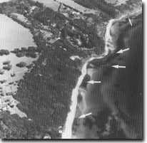
 Sites 70, 71, 72. Arrows show significant outcrops that occur in the intertidal zone and are exposed only during very low tides. |  Site 72. Exhumed granite platform south of Sunnyside |


