
L7 - Bald Hill (Bacchus Marsh) - Fault
|
This information has been developed from this publication:
|
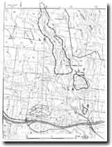
| Location: | Lerderderg - 715298. Shire of Bacchus Marsh. Southern slopes of Bald Hill, 5 km northwest of Bacchus Marsh. | |
Access: | Tramway Lane. | |
Ownership: | Private land. | |
Site Description: | A fault striking east-west brings Older Volcanics into contact with Permian sediments on the southern flanks of Bald Hill. There is no topographic expression but the fault trace is clearly marked by a change in outcrop and soil type. | |
Significance: | Regional. The site is a clear example of a fault trace without marked topographic expression. | |
Management: | Class 2. Continued cultivation of the site assists in delineating the soil and rock types. No roadway should be constructed along the line of the fault. | |

© State of Victoria (Agriculture Victoria) 1996 - .

This work, Victorian Resources Online, is licensed under a Creative Commons Attribution 4.0 licence. You are free to re-use the work under that licence, on the condition that you credit the State of Victoria (Agriculture Victoria) as author, indicate if changes were made and comply with the other licence terms.
The licence does not apply to ‘branding’ or some ‘images or photographs’ that may be owned by third parties. We ask you to seek prior approval to use images using the VRO feedback form. Access to higher quality images can also be provided on request.
This page was last updated on .