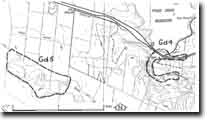
Gd5 - Werribee River - Knickpoint
|
This information has been developed from this publication:
|
| Location: | Greendale - 580335. Shire of Ballan. Valley of Werribee River , 1 km south of the bridge on the Ballan Road (Old Melbourne Road). | |
Access: | Old Melbourne Road. | |
Ownership: | Private land. | |
Site Description: | Along this sector of the stream, the gradient of the Werribee River steepens rapidly and the valley becomes more deeply incised into lava flows from Mount Gorong. Further downstream, incision has reached the base of the basalt and exposed Permian and Ordovician sediments. Morphological features of the valley include alluvial terraces, abandoned high-level meanders and basalt remnants in meander cores. The site represents the main knick point in the Werribee River upstream of the Werribee Gorge. | |
Significance: | Regional. The Werribee valley is the major drainage basin of the study area, and changes in valley morphology are expressions of the geological history and tectonic processes of the region. This sector of the valley represents the point at which stream incision has worked upstream from the Werribee Gorge following the uplift and rejuvenation caused by the Rowsley Fault. | |
Management: | Class 2. This sector of the valley would be best preserved by maintaining rural land use or some other form of low intensity use. | |
 Site - Gd4 |


