
EC1 - Durdiwarrah - Lunette
|
This information has been developed from this publication:
|
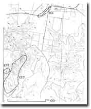
| Location: | Eclipse Creek - 487098. Shire of Bannockburn. South of ‘Darra’ homestead on northern side of Meredith-Durdiwarrah Road. | |
Access: | Meredith-Durdiwarrah Road. | |
Ownership: | Private land. | |
Site Description: | A gently curving sand ridge lies around the eastern side of large swampy depression. The sand is a beach and dune deposit derived from the floor of the depression when it was an intermittent lake. | |
Significance: | Regional. The site is the most distinct lunette noted in the study area. | |
Management: | Class 2. The site is currently planted to pines which reduces further deflation of the sand body. Continuation of rotational harvesting of this plantation would be an appropriate land use to maintain the significance of the site. Limited sand extraction could be permitted, provided this did not deplete more than 50% of the sandy body, and was confined to one sector rather than distributed across the entire lunette. | |

© State of Victoria (Agriculture Victoria) 1996 - .

This work, Victorian Resources Online, is licensed under a Creative Commons Attribution 4.0 licence. You are free to re-use the work under that licence, on the condition that you credit the State of Victoria (Agriculture Victoria) as author, indicate if changes were made and comply with the other licence terms.
The licence does not apply to ‘branding’ or some ‘images or photographs’ that may be owned by third parties. We ask you to seek prior approval to use images using the VRO feedback form. Access to higher quality images can also be provided on request.
This page was last updated on .