L3 - Lerderderg Valley, Darley - Glacial Rocks
|
This information has been developed from this publication:
|
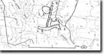
| Location: | Lerderderg - 726315. Shire of Bacchus Marsh. Lerderderg Valley 3 to 3.5 km north of Darley. |  Lerderderg Valley, Darley |
Access: | Swans Road and Links Road. | |
Ownership: | Private land. | |
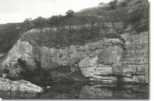
Site Description: | Active river cliffs and older valley-side bluffs expose glacial conglomerates and sandstones of the Bacchus Marsh Formation. The unconformity with the underlying Ordovician rocks occurs at river level but is not clearly exposed. The section includes 9 tillite beds and striated boulder surfaces that indicate at least 12 glacial phases in the area. Detailed studies of this area by several authors have determined that the outcrops record a complex history of glacial advance and retreat. | |
Significance: | National. Glacial rocks are unusual in the geological record in Australia. The glacial rocks of the Bacchus Marsh district contribute significantly to the understanding of this major episode of Palaeozoic glaciation. They have been studied in detail and correlated with glacial sequences of similar age in other parts of Victoria and Australia. The outcrops are restricted in distribution and exposure in Victoria and those of the Darley area warrant classification at the National level. | |
Management: | Activity of any kind that would cover, damage or remove these outcrops should be prohibited. Consideration should be given to acquiring the river banks and bluffs into public ownership to ensure adequate protection of these significant outcrops. Alternatively, landholders should be required to locate structures away from these areas and not to permit activities on the property that would cause the exposures to be obscured. | |
References: | Bowen RL and Thomas GA (in Douglas JG and Ferguson JE) (1976) Crowell JC and Frakes LA (1971) Roberts P (1984, 1985) | |
 Site - L3 |


