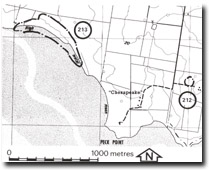
213. Chesapeake - Sand Ridges
|
This information has been developed from one or more of these publications:
|
| Location: | Rhyll - 525480. 1 km north-west of ‘Chesapeake’ homestead. | |
Access: | Walk from Peck Point. | |
Ownership: | Crown land and private land. | |
Geology/Geomorphology: | A small embayment is enclosed by low sand ridges that have grown from the west as a series of small spits. A small tidal creek drains the embayment and at the entrance there is a second spit which has grown from the south-east. | |
Significance: | Regional. The site is an example of paired spits at an embayment entrance and shows how the coast is modified by sand accretion. | |
Management: | Class 2. Weathering of vegetation and quarrying of sand should be prohibited. | |


