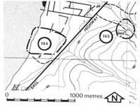
145. The Gurdies - Baxter Formation
|
This information has been developed from one or more of these publications:
|
Location: | Grantville - 744504. Three kilometres north-east of Grantville. | |
Access: | Bass Highway. | |
Geology: | Sands and clays of the Baxter Formation are exposed in the quarry. They are heavily ferruginised and display pronounced cross-bedding. Steep dips are recorded as the site lies along the line of the Heath Hill Fault. | |
Significance: | Regional. The site provides a major exposure of the lithology and structures of beds of the Baxter Formation. | |
Management: | Class 2. Continued quarrying will maintain exposures at the site. The principles of quarry management should be consulted. | |
References: | Spencer-Jones, D., Marsden, M.A.H., Barton, C.M. & Carrillo-Rivera, J.J., 1975. Geology of the Western Port sunkland. Proc. Roy. soc. Vict. (87) 1&2, 43-68. McMickan (1977). | |


