
A Land Capability Study for the Shire of Broadford
- A Land Capability Study for the Shire of Broadford chapters
- A Land Capability Study for the Shire of Broadford Appendix
- A Land Capability Study for the Shire of Broadford Units D
- A Land Capability Study for the Shire of Broadford Units Q
- A Land Capability Study for the Shire of Broadford maps
The Department of Conservation and Natural Resources was involved in formal land capability assessment studies since the early 1970s. The Land Capability Section of the (then) Soil Conservation Authority established the framework for the conduct of formal land capability studies upon which this work was based. This framework included rating tables for some thirty activities. Ratings for various activities were presented as thematic maps, or combined into ratings for various land uses, depending upon the needs and abilities of the client.
The Shire of Broadford was the third municipality to be studied in the series of investigations. The study was conducted by E J Bryant, M R Bluml, G Boyle and E Jones of the former Department of Conservation & Natural Resources in February 1994. The primary objective was to provide the municipality with detailed land resource information, consisting of base data on the nature of the land and of assessments of the likely performance of the land under various activities. This information can underpin many land use and management decisions by the municipal authority. In doing so, many of the problems and unexpected costs which would be incurred by the use of the land beyond its capabilities can be avoided.
To view the information PDF requires the use of a PDF reader. This can be installed for free from the Adobe website (external link).
| Qa1 (PDF 99KB) | Qa2 (PDF 99KB) | Qa3 (PDF 99KB) | Qa4 (PDF 99KB) | Qf1d (PDF 100KB) | Qf1f (PDF 100KB) | Qf2f (PDF 98KB) |
| Qf2g (PDF 98KB) | Qf3c (PDF 99KB) | Qba (PDF 98KB) | Qbc (PDF 99KB) | Qbd (PDF 99KB) | Qbf (PDF 99KB) | Qbg (PDF 99KB) |
| Qbh (PDF 99KB) | Dga (PDF 99KB) | Dgb (PDF 98KB) | Dgc (PDF 99KB) | Dgd (PDF 99KB) | Dsa (PDF 99KB) | Dsb (PDF 99KB) |
| Dsc (PDF 99KB) | Dsd (PDF 100KB) | Dse (PDF 99KB) | Dsf (PDF 100KB) | Dsg (PDF 100KB) | Dsh (PDF 100KB) |
 | Front Page and Table of Contents (PDF 109KB) | |
| Preface and Summary (PDF 88KB) | ||
1 | Introduction (including Table 1.1 - Summary of Land Capability Ratings (PDF 247KB) | |
2 | Land Capability Assessment (PDF 126KB) | |
3 | Land Management Guidelines (PDF107KB) | |
4 | Detailed Map Unit Descriptions and Capability Ratings (PDF 85KB) (for individual Map Unit Descriptions - see list above) | |
5 | Description of the Environment (PDF 1.9MB) | |
6 | Acknowledgements (PDF 1.9MB) | |
7 | References (PDF 1.9MB) | |
| Appendix A - Notes to accompany Land Capability Rating Tables (PDF 154KB) | ||
| Appendix B - Working Tables for Land Capability Ratings (PDF 66KB) | ||
| Appendix C - Sepcific Methodology (PDF 513KB) | ||
| Appendix D - Physical and Chemical Laboratory Results (PDF 77KB) | ||
| Appendix E - Criteria used for establishing Recharge Values (PDF 88KB) | ||
| Glossary (PDF 118KB) | ||
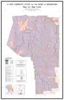 A Land Capability Study for the Shire of Broadford - Map 1a: Map Units (PDF 542KB) | 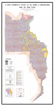 A Land Capability Study for the Shire of Broadford - Map 1b: Map Units (PDF 482KB) |

© State of Victoria (Agriculture Victoria) 1996 - .

This work, Victorian Resources Online, is licensed under a Creative Commons Attribution 4.0 licence. You are free to re-use the work under that licence, on the condition that you credit the State of Victoria (Agriculture Victoria) as author, indicate if changes were made and comply with the other licence terms.
The licence does not apply to ‘branding’ or some ‘images or photographs’ that may be owned by third parties. We ask you to seek prior approval to use images using the VRO feedback form. Access to higher quality images can also be provided on request.
This page was last updated on .