
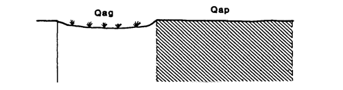
Marong map unit Qap
Back to: A Land Capability Study of the Rural City of Marong
| Map Unit: | Quaternary alluvium, plain | Map Unit Symbol: | Qap |
| % of Study Area: | 44.9 |
General Description:
Extensive Riverine Plain extending across the north of the Rural City. The soils are predominantly red duplex with hardsetting sandy loam top soils, hardsetting and bleached A2 horizons and red clay subsoils which become yellow brown and mottled at depth. These soils overly the remnants of an older soil profile which consists of a reddish brown mottled clay with calcium carbonate nodules. Minor soil variations include yellow subsoils with red mottling in areas of poor drainage, and sporadically bleached A2 horizons or an absence of A2 horizons at sites of higher elevation. Sandy soils associated with prior streams, occur throughout the plain but are too small to map.
Site characteristics:
| Parent material age: | Quaternary | Depth seasonal watertable: | 2-5 m |
| Lithology: | Alluvium | Potential recharge to groundwater: | Low |
| Landform Pattern: | Alluvial Plain | Flooding risk: | Nil |
| Element: | Flat | Drainage: | Well drained |
| Slope common: | 1% | Depth to hardrock: | > 1.5 m |
| Slope range: | 0-2% | ||
| Rock outcrop: | 0% |
Major vegetation: Grey Box, Yellow Gum, Red Gum, Golden Wattle, Yellow Box, Round-leaf Wattle, Hedge Wattle, Kangaroo Grass, Lightwood, Buloke, Wallaby Grass,Black-anther Flax-lily.
Present land use: Broadacre cropping, grazing (major), residential (minor).
| Land degradation: | Water erosion | Wind erosion | Salting | Acidification | |
Sheet/rill | Gully | ||||
| Susceptibility | Low | Moderate | Low | Low | High |
| Incidence | Low | Low | Low | Low | Moderate |
Soil profile characteristics:
| Permeability (measured - average, range): | 468, 44-1440 mm/day |
| Permeability (estimated): | - |
| Available water capacity: | 221 mm H2O |
| Linear shrinkage (B horizon): | 7.5% |
Soil profile description:
| A1 | 0-15 cm | Dark brown (7.5YR3/4) whole coloured sandy loam, weak structure, subangular blocky peds 2-5 mm, rough fabric, very weak consistence, moderate organic matter, pH 5.4. Clear transition to |
| A2 | 15-34 cm | Dull brown (7.5YR5/4) hardsetting sandy loam, bleached (7.5YR7/4) when dry, massive, moderately weak consistence, less than 2% quartz fragments, pH 5.3.Clear transition to |
| B21 | 34-72 cm | Dull reddish brown (5YR4/3) light clay, moderate structure, subangular blocky peds 10-20 mm, smooth fabric, moderately firm consistence, pH 6.3. Clear transition to |
| B22 | 72-90 cm | Dull yellowish brown (10YR5/4) light clay, common faint red mottles, moderate structure, angular blocky peds 10-20 mm, smooth fabric, moderately firm consistence, pH 8.2. Clear transition to |
| C | 90-108 cm | Orange (5YR6/6) sandy clay loam, weak structure, angular blocky peds 10-20 mm, smooth fabric, very firm consistence, less than 2% calcareous nodules, pH 8.7. Clear transition to |
| 2B2 | 108-150 + cm | Dull reddish brown (2.5YR4/4) medium clay with a few distinct grey mottles, strong angular blocky peds 2-5 mm, smooth fabric, moderately firm consistence, less than 2% calcareous nodules, pH 8.8. |
Soil classification:
| Factual Key (Northcote): | Dr 2.43 (major), Dy 3.41/2/3, Dr 2.12 (minor) |
| Australian Soil Classification: | Hypocalcic, Subnatric, Red, Sodosol; very deep, thick, clay loamy, non-gravelly |
| Unified Soil Group: | CL |
Interpretation of soil analyses*
Horizon | pH | Gravel % | E.C. (salts) | Nutrient Status | P | K | Al | Organic Matter | Dispersibility |
| A1 | 5.4** | < 1 | VL | VL | D | S | T | M | L |
| A2 | 5.3** | < 1 | Vl | F | S | S | S | VL | L |
| B21 | 6.3 | < 1 | L | L | D | S | S | S | H |
| B22 | 8.2 | < 1 | L | M | D | S | S | S | H |
| C | 8.7 | 1.8 | L | M | D | S | S | S | H |
| 2B2 | 8.8 | 5.8 | M | H | D | S | S | S | H |
Land capability assessment
Land Use | Class | Major limiting feature(s)/ landuse |
| Agriculture (CTS values) | C3T2S3 | Moderately susceptible to gully erosion, dispersible top soil poor condition of the A2, climate |
| Effluent disposal (septic tanks) | 2 | Nil |
| Farm dams (earthen) | 5 | Low suitability of subsoil, highly dispersible subsoil, moderate permeability |
| Building foundations - slab | 2 | Nil |
| Building foundations - stumps/footings | 2 | Nil |
| Secondary roads | 3 | Universal Soil Group |
| Urban residential | 3 | Secondary roads |
| Rural residential | 4 | Farm dams |
The high resolution PDF file provided on this page can be viewed using the free Adobe PDF reader, this software can be installed for free from the Adobe website (external link).
A Land Capability Study of the Rural City of Marong - map unit Qap - (PDF - 45.5 KB)
© State of Victoria (Agriculture Victoria) 1996 - 2025.

This work, Victorian Resources Online, is licensed under a Creative Commons Attribution 4.0 licence. You are free to re-use the work under that licence, on the condition that you credit the State of Victoria (Agriculture Victoria) as author, indicate if changes were made and comply with the other licence terms.
The licence does not apply to ‘branding’ or some ‘images or photographs’ that may be owned by third parties. We ask you to seek prior approval to use images using the VRO feedback form. Access to higher quality images can also be provided on request.
This page was last updated on 23/03/2020.