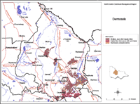
Dermosols
Dermosols have structured subsoils and lack strong texture contrast between A and B horizons.
Hillslope Dermosols occur mostly in erosive situations on Palaeozoic sediments, with stony profiles that are usually less than 0.5 m thick. Sodosols occupy the lower situations. There are some areas with deep Dermosols, for example on colluvium along the Mt Camel Range, on the numerous metamorphic aureoles, and to the south of the Eppalock Reservoir.
| This map of Dermosols in the North Central region has been developed by Jim Rowan and is based on the and Systems of Victoria (1:250 000). It shows areas where Dermosols are most likely to occur within the region. Note that other soil types may also occur within these mapped areas (although they are likely to be a more minor component). |  Dermosols North Central Region |
Volcanic plain Dermosols occupy erosive situations on stony rises or scarps. Profiles are shallow, stony and red, brown or grey depending on drainage status. Associated soils are Vertosols on alluvium.
Friable Red Dermosols are similar to Ferrosols, but lack the high free iron oxide contents, and often have high stone contents. They occur on the steep slopes of the Mt. William Range (composed of Cambrian volcanic and sedimentary rocks), on the Macedon Range (composed of rhyodacite), and on the gentle slopes on Palaeozoic sediments to the west of Woodend.


