
Private Land
| Private land in the North East comprises approximately one million hectares (about 46% of the catchment region), most of which is cleared for agriculture. Most of the region’s private land is located in the west and north of the catchment and along major river valleys (C of A and Victorian RFA Steering Committee, 1998). Approximately 43% (12 595 hectares) of the region’s agricultural land consists of pasture (irrigated and dryland). On the Plains country there is broadacre cropping of wheat, oats, triticate, barley, lupins, peas and canola, whilst apples, berries and nuts are grown around Beechworth and the Ovens Valley. About 8% of the region’s agricultural land is utilised for intensive cropping with approximately 19 800 tonnes produced in horticultural crops over an area of 2 377 hectares. Land utilised for livestock enterprises dominates total livestock land use (accounting for 58% of the total area used for livestock) while 35% is used for sheep grazing. A relatively small area of land is used for dairying and intensive livestock enterprises (NECALPB, 1997). | 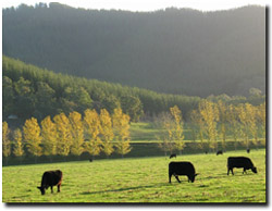 Land Use in the Bright Area |
Forest plantations are extensive in the North East, situated around Bright, Myrtleford, Beechworth and the Upper Murray catchment. These cover approximately 65 400 hectares, or 3% of the total catchment area.
North East Land Use and Tenure:
Land Tenure | Area (ha) | Proportion of all land (%) | Proportion of public Land (%) |
State Forest | 718 700 | 31 | 57 |
Conservation reserves | 392 000 | 17 | 31 |
Other public land | 56 200 | 2 | 5 |
Plantation | 65 400 | 3 | 5 |
Water bodies | 28 400 | 1 | 2 |
Public Land Total | 1 260 700 | 54 | - |
Private Land | 1057 300 | 46 | - |
Changes in forest land use throughout the North East have been brought about by the following key policy changes in Victoria:
- Victoria’s Timber Industry Strategy (1986)
- The Code of Forest Practices (1989)
- The State Plantations Impact Study (1990)
- The National Forest Policy Statement (1992)
- Implementation of LCC recommendations for the use of public land.
(C of A and Victorian RFA Steering Committee, 1998)
Sub-regional Land use
Land use by Resource Management Unit (RMU)
The alpine and plateaux RMUs are designated entirely for non-farmland uses since most of this is public land. Meanwhile, most of the Eastern Mountains and Hills RMU (over 981 000 hectares, or 40% of the total RMU area in the North East) is used for the same purpose while only 5% is utilised for dryland pasture and dairy/mixed grazing. Dryland pasture dominates land use in the Eastern Floodplains and Terraces RMUs, accounting for 72% of the total land mass. Meanwhile, dryland pasture and dairy/mixed grazing enterprises account for 58% of the Northern Footslopes in the North East region (27% of this RMU is devoted to non-agricultural land uses). Finally, the Northern Riverine Plains are used primarily for dryland pasture (52% of total area) and broadacre cropping/grazing (42%) (NECALPB, 1997).
Upper Murray Catchment
Land use within the Upper Murray catchment involved extensive clearing of savanna woodland and adjacent sclerophyll forest soon after European settlement. Today, all the major valleys which lie in the north have been cleared for agriculture, although roughly 80% of the catchment remains forested. The principal forms of land use are water conservation, forestry, grazing and agriculture (dairying is the major industry). Grazing of sheep for wool and meat, and beef cattle fattening have also been significant land uses in the past. On the High Plains, graziers run cattle on both private and public land, resulting in severe gullying in the Omeo-Benambra area.
Kiewa River Catchment
First European settlement occurred in the Kiewa River catchment in 1835, and numerous pastoralists were soon to follow. The river flats and terraces were cleared and today they provide some of the most productive land in the State. Only one third of the catchment, principally the steeper hilltops, remains forested. Intensive dairying is carried out in the main valley near Dederang, and tobacco growing predominantly on the lower slopes around Mt Beauty. The high mountain grassland and herbfield have provided summer grazing pastures for beef cattle since the 1850’s. However, this practice has raised many environmental issues and a committee of management now regulates grazing on the High Plains.
Ovens River Catchment
In the Ovens River Catchment cattle and sheep grazing was soon followed by gold mining in the 1850’s, which extended from the Alps to the Murray River. After the gold rush ended, many miners turned to agriculture for a livelihood. It was during this period that tobacco and hop growing was established. Today, tobacco is the most economically significant crop in the catchment and the Ovens/King region, usually producing about 75% of the tobacco grown in Victoria. The crop is confined to the alluvial river flats and adjacent slopes suitable for irrigation and is most highly concentrated around the middle reaches of the Ovens River. Other important agricultural activities are livestock production, sheep for meat (and until recently wool), beef cattle and some dairying. In the central and south-eastern regions of the catchment, hardwood logging and grazing are also significant land uses, while agriculture is concentrated between Beechworth and Chiltern.
(DWR, 1989)
References
Commonwealth of Australia (C of A) and Victorian RFA Steering Committee (1998). North East Victoria: Comprehensive Regional Assessment. Commonwealth of Australia, Canberra.
Department of Water Resources (1989). A Water Resource Handbook, Melbourne.
North East Catchment and Land Protection Board (NECALPB) (1997). Regional Catchment Strategy, Victoria.
© State of Victoria (Agriculture Victoria) 1996 - 2025.

This work, Victorian Resources Online, is licensed under a Creative Commons Attribution 4.0 licence. You are free to re-use the work under that licence, on the condition that you credit the State of Victoria (Agriculture Victoria) as author, indicate if changes were made and comply with the other licence terms.
The licence does not apply to ‘branding’ or some ‘images or photographs’ that may be owned by third parties. We ask you to seek prior approval to use images using the VRO feedback form. Access to higher quality images can also be provided on request.
This page was last updated on 25/01/2019.