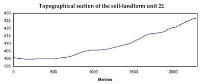
Soil/Landform Unit 22
Landform Unit Description
Page top
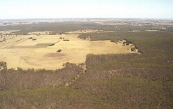 Grassy forests are the main remnant vegeation class of this unit |
0.10% of CMA region This plains unit is underlain by Cainozoic gravel within the dissected Western Uplands. This unit (comprising a few relatively small occurrences) is part of an undulating plain and rise catena formed on older (Palaeozoic) sediments (Unit 9) with a younger sedimentary (Neogene) capping in places. The soils are acid and neutral mottled brown and yellow texture contrast soils (Kurosols and Chromosols) which may be sodic (Sodosols), especially where drainage is restricted. Poor aggregate stability and surface soil structure, as well as texture contrast characteristics, make this unit susceptible to sheet, rill and gully erosion, and local waterlogging. Soil structural concerns (decline and compaction) are lessened by the low relief. Land use is a mixture of extensive grazing, minor cropping, forestry and native vegetation. | 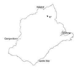 |
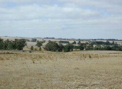 Cleared land is mainly used for grazing and cereal cropping | 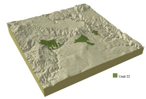 |
| 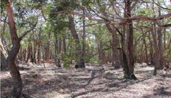 Remant vegeation stand south of Clarendon |
Component | 1 | 2 |
Proportion of soil-landform unit | 80% | 20% |
| CLIMATE Rainfall (mm) | Annual: 710 | |
| Temperature (oC) | Minimum 7, Maximum 19 | |
| Precipitation less than potential evapotranspiration | November-March | |
| GEOLOGY Age and lithology | Neogene fluvio-marine sand, Orodivician marine sandstone and shale | |
| Geomorphology | ||
| LANDUSE | Uncleared: Nature conservation; hardwood and softwood plantations Cleared: Sheep and beef cattle grazing; gravel extraction; mining; cropping (cereal) | |
| TOPOGRAPHY Landscape | Undulating rises | |
| Elevation range (m) | 360-447 | |
| Local relief (m) | 20 | |
| Drainage pattern | Dendritic | |
| Drainage density (km/km2) | 2.3 | |
| Landform | Plains and rises | |
| Landform element | Well drained non-sandy areas | Poorly drained non-sandy areas |
| Slope and range (%) | 2 (1-3) | 0 (0-2) |
| Slope shape | Convex | Flat |
| NATIVE VEGETATION Structure | Low open forest - woodland | Low open forest-woodland |
| Dominant species | Callitris columellaris, E. viminalis, E. obliqua, E. radiata, E. rubida, E. ovata, E. pauciflora | E. ovata |
| SOIL Parent material | Unconsolidated gravel, sand and clay | Unconsolidated gravel, sand and clay |
| Description (Corangamite Soil Group) | Red mottled, brown/grey or yellow texture contrast soil, fine structure (13) | Brown/grey or yellow sodic texture contrast soil, coarse structure (14) |
| Soil type sites | ||
| Surface texture | Sandy clay loam to loamy sand | Clay loam |
| Permeability | Moderate | Low |
| Depth (m) | 2 | 2 |
| LAND CHARACTERISTICS, POTENTIAL AND LIMITATIONS | Hardsetting surfaces are prone to overland flow and sheet and rill erosion. Subsoils are dispersible, while surface soil often experiences leaching of salts. | Hardsetting surfaces are prone to overland flow and sheet and rill erosion. Subsoils are dispersible, while surface soil often experiences leaching of salts and compaction. |

