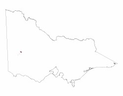
5.5.3 Prominent ridges with eroded ferruginized northern spurs (south of the Lower Norton Wimmera Bridge)
5. North Western Dunefields and Plains (DP)
5.5 Ridges with sand, and flats (Goroke, Nhill)
| Prominent ferruginised ridges are exposed south of the Wimmera River and merge into an extended plain to the south. This unique unit of 5,300 ha occurs in the Wimmera region of western Victoria, It lies south of the original small Quantong irrigation settlement and the Wimmera River, It is immediately south of the road junction at Lower Norton, east of the East Natimuk-Noradjuha road and west of Norton creek, Two roads traverse the unit, the Lower Norton- Noradjuha road and the more easterly Lower Norton- Toolondo road. This latter road crosses the centre of the unit for about 7 km, Terraced land, the Wimmera map unit (4.1), and the alluvial flood plain, the Drung map unit (4.2.2), lie to the north and north east of this unit, The alluvial apron, the Yallambee map unit (4.3), lies to the south east and south west, Within the unit geomorphological processes are unique in that they have resulted in topography and set of landform elements not seen elsewhere in the region, Erosion by the west flowing Wimmera river has resulted in a sequence of 7 sets of spur-valley units along the northern and north eastern boundaries of the unit. For the eastern 4 spurs the average distance from the 130 m contour, near the map unit boundary,across the alluvial flood plain to the 120 m contour within the Wimmera map unit is about 1 km. For the 5 eastern ridges slopes down, from south to north, along the axis of the crests average about 1%. For the spurs east and west side slopes range from 2 to 5 %, The overall erosional landform pattern of the unit may be described as a set of elongate undulating rises. |  |
The unit occurs mainly between the 130 m and 150 m contours. To the south of the unit land surfaces continue to rise to above the 160 m contour within the adjacent Yallambee map unit, Landform elements within the 5.5.3 unit may be a relatively dramatic example reflecting truncation of the ridges by the Wimmera river in the north and lateral erosion of the ridges which is less effective to the south where these ridges become more subdued within the landscape towards the Dundas tableland, Narrow valleys between the spurs contain several unnamed unidirectional stream channels which under flood conditions may flow north across the flood plain to join the Wimmera river,
Deeply weathered texture contrast soils are dominant across the unit. Sodosols occur on the crests and slopes of the ridges with red and brown Sodosols on crests and red Sodosols on slopes,Sodosols with cemented subsurface horizons and mottled subsoils occur on inter -ridge corridors. Ironstone gravels in varying amounts are commonly present both as a surface pavement and throughout soil profiles. Varying amounts of soft and hard carbonate segregations are often present in subsoils, Bleached Tenosols occur on terrace landform elements along inter-ridges corridors Grey Box and Yellow Gum occur along narrow valley floors.


