The Jim Jim
|
This information has been obtained from the report: Eruption Points of the Newer Volcanic Province of Victoria by Neville Rosengren. This report was published in 1994 and was prepared for the National Trust of Australia (Victoria) and the Geological Society of Australia (Victorian Division). The review of eruption points was based on an earlier unpublished manuscript Catalogue of the post-Miocene volcanoes of Victoria compiled by O P Singleton and E B Joyce (Geology Department, University of Melbourne 1970). |
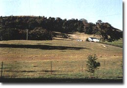
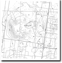
| 37 18 00S 144 35 00E (external link): (Woodend) 8566691. 6 km NE of Woodend. Jim Jim Road. |  The Jim Jim | |
Newham and Woodend. | ||
Private land. Vineyard on SE slopes, some areas timbered, some outcrop. | ||
Type 10: | Other eruption type (mamelon and lava flow). | |
The Jim Jim formed from an eruption of relatively viscous and orthoclase trachyte lava cooling as a steep sided and hummocky dome. A younger flow of basalt from a gentler slope on the southern side and there is a small parasitic cone on the lower western slopes. | ||
745 m; 170 m. | ||
Regional: | An example of the diverse geological and geomorphological products of the Newer Volcanics of the Macedon-Woodend area. | |
References: | Skeats, E.W. & Summers, H.S. (1912). The geology and petrology of the Macedon district. Geological Survey of Victoria Unpublished Report 1975/75. Edwards, A.B. (1938). The Tertiary volcanic rocks of central Victoria. Quarterly Journal of the Geological Society of London 94, pp. 243-320. | |
 The Jim Jim 7823-3-4 (Woodend) | ||
| vro |


