Fitzgerald Hill
|
This information has been obtained from the report: Eruption Points of the Newer Volcanic Province of Victoria by Neville Rosengren. This report was published in 1994 and was prepared for the National Trust of Australia (Victoria) and the Geological Society of Australia (Victorian Division). The review of eruption points was based on an earlier unpublished manuscript Catalogue of the post-Miocene volcanoes of Victoria compiled by O P Singleton and E B Joyce (Geology Department, University of Melbourne 1970). |
| Compass Hill | 37 31 60S 144 39 60E (external link); 7822-4-1 (Sunbury) 936430. 4 km NW of Sunbury. Dalrymple Road, Mundy Road. |  Fitzgerald Hill Lava Disc |
Bulla. | ||
Private land. | Grazing, adjacent to residential subdivision, outcrop. | |
Type 3: | Lava disc. | |
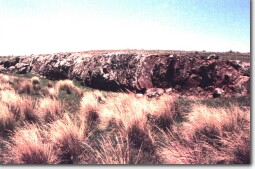
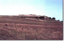
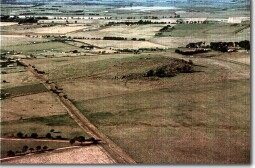
Fitzgerald Hill is probably a small lava disc overlying broader lava flows. There are parallel groups of small rocky escarpments which are most prominent high on the eastern side and lower on the western slope. The outcrops give a very clear indication of the structure of the edges of lava flows. | ||
420+m; 15 m. | ||
State: | The hill is a small, easily accessible and very clear example of a lava disc eruption. As yet (June 1992) it has not distracted land use and is one of the few volcanoes of this type in the Gisborne-Sunbury area not yet subdivided for residential or small farm holding. | |
References: | Edwards, A.B. & Crawford, W. (1940). The Cainozoic volcanic rocks of the Gisborne district, Victoria. Proceedings of the Royal Society of Victoria 52, pp. 281-311. | |
 Fitzgerald Hill |  Fitzgerald Hill | |
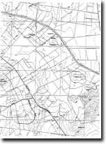
 Fitzgerald Hill 7822-4-1 (Sunbury) |


