Soils of the Cranbourne - Koo Wee Rup region
General Land Use | Geology of the Region | References
This material is based on a publication entitled 'Major Agricultural Soils of the Cranbourne and Koo-Wee-Rup Region' (Sargeant and Imhof et al, 1996). This was initially prepared for a Soil Pit Field Day in May 1996.
The report consolidates much of the work done under three separate reports commissioned by the following organisations:
|  |
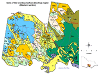
These maps were developed for the report: 'Major Agricultural Soils of the Cranbourne - Koo Wee Rup Vegetable Growing Region' by Sargeant and Imhof et al. The original mapping was undertaken by Ian Sargeant for the former Shires of Pakenham and Cranbourne, and the former Ministry for Planning in conjunction with the City of Casey. These maps were originally prepared at scales of 1:10 000 or 1:25 000. | |
The former Shire of Pakenham requested an evaluation of the soils in part of their Shire in order to define the then proposed Horticultural Preservation Zone (Sargeant 1993). This Zone was proposed to maintain and enhance the valuable agricultural activity currently taking place in the southern area of the Shire of Pakenham known as the Koo-Wee-Rup Swamp. The proposed controls were to place greater restriction upon subdivision, house construction and uses (including agricultural activities) not dependent upon the prime agricultural land. This statutory planning initiative was considered vital to the continuation of the local agricultural economy in the face of impending development pressures associated with the increase in population in the nearby South Eastern Growth Corridor.
The former Shire of Cranbourne, which then adjoined the former Shire of Pakenham, requested a similar evaluation of part of their Shire (Sargeant 1994). However, before any statutory planning schemes could be initiated, shire amalgamations occurred and much of the area originally administered by the Shire of Cranbourne lied within the new Shire of Cardinia.
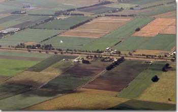
| The former Ministry for Planning in conjunction with the City of Casey requested an evaluation of the soils south of Cranbourne to provide information on their agricultural potential and to aid future planning (Sargeant 1995). Permission to repackage material from the above work into a single publication was given to Agriculture Victoria by the Shire of Cardinia, the City of Casey and the former Ministry for Planning. It should be noted that the maps presented in this publication are at a scale of 1: 50 000, whereas the maps in original reports were at a scale of 1:10 000 or 1: 25 000. Some minor changes have been made to soil mapping unit names and soil profile descriptions since original publication. |  Aerial view over part of the Koo-Wee-Rup region |
Soil pit descriptions were undertaken in March 1996. These sites were selected as example soil profiles for some of the major mapping units in the area and results from these should be used as a guide only. Samples taken from the pit sites represent only one spot within a paddock and may not be representative of the whole paddock or of the mapped unit. Natural variations will occur within a mapped soil type, so soil maps should be used with some caution when assessing soils within a paddock. It is recommended that testing (soil and plant tissue) be carried out every one to two years for intensively cropped paddocks in order to assess nutrient status. Sampling should also take place across a cropping paddock to account for variability.
Relevant information elsewhere on VRO website
Soil Pit Sites in Cranbourne - Koo Wee Rup region


