A Land capability study of the City of Greater Bendigo, Strathfieldsaye District - Technical Report No. 20
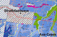
The Strathfieldsaye District (previously the Shire of Strathfieldsaye) was amalgamated into the new City of Greater Bendigo municipality in April 1994. The District is approximately 600 km2 in area and adjoins the City of Bendigo to the south-east. Much residential development has occurred close to the City of Bendigo. The remaining area is predominantly rural or rural residential. There are extensive but fragmented areas of public land which cover approximately 30% of the Municipality.
This study by M R Bluml, G Boyle and E Jones of the former Department of Conservation and Natural Resources, completed in October 1995; describes in detail the land present in the Strathfieldsaye District and provides information relevant to land use planning and assessment.
To view the information PDF requires the use of a PDF reader. This can be installed for free from the Adobe website (external link).
 | Front Page and Table of Contents (PDF 52KB) | ||
| User Guide (PDF 12KB) | |||
| Preface (PDF 10KB) | |||
| Summary (PDF 21KB) | |||
1 | Introduction (PDF 39KB) | ||
2 | Land Capability Assessment (PDF 47KB) | ||
3 | Land Management Guidelines (PDF 25KB) | ||
4 | Detailed Map Unit Descriptions and Capability Ratings (PDF 769KB) | ||
5 | Acknowledgements (PDF 19KB) | ||
6 | References (PDF 16KB) | ||
| Appendix A - Notes to accompany Land Capability Rating Tables (PDF 56KB) | |||
| Appenidix B - Working tables for Land Capability Classes (PDF 711KB) | |||
| Appendix C - Specific Methodology (PDF 22KB) | |||
| Appendix D - Physical Laboratory Results (PDF 552KB) | |||
| Appenidix E - Criteria used for establishing recharge values (PDF 1.0MB) | |||
| Appendix F - Land systems hierarchy (PDF 14KB) | |||
| Glossary (PDF 31KB) |


