GL164
| Site: GL164 | Land Unit: Dundas Sedimentary |
| Aust. Soil Class.: Mottled, Petroferric, Brown CHROMOSOL (confidence level 1) | |
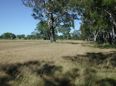
 | General Land Unit Description: This site is situated on the flat surface of the Dundas Tablelands. Red gums are the dominant vegetation found on this surface. The dominant soil type is a Brown Chromosol, commonly with a ferric horizon which, in some cases, may be cemented (petroferric). The soil is developed over a highly weathered mottled zone. This mottled zone sometimes referred to as ‘tiger mottling’ is thought to be the result of fluctuating watertables which occurred mainly in the Tertiary period. |
Site Description:
| Slope: 0-1% | Geology: Tertiary marine sandstone |
| Landform pattern: Level plain | Position in landscape: Flat |
| Internal drainage: Moderately well drained |
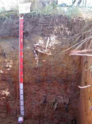
| A1 | 0-25 cm | Very dark grey (7.5YR3/1) sandy loam, weak blocky structure (10-50 mm), weak consistence when dry, very few medium angular ferruginised nodules (6-20 mm), pH 6.5. Clear and wavy transition to: |  |
| A2 | 25-40 cm | Dark yellowish brown (10YR4/4) fine sandy clay loam, weak to massive blocky structure (10-50 mm), firm consistence when moist, many medium to coarse ferruginous and manganiferous nodules, pH4.7. Clear and wavy transition to: | |
| Subsoil | |||
| B2 | 40-60 cm | Dark yellowish brown (10YR4/6) light medium clay, sandy, weak blocky structure (5-10 mm), firm consistence when moist, many coarse ferruginous and manganiferous nodules, pH 5.5. Clear but wavy transition to: | |
| BC | 60-85 cm | Mainly buckshot, ferruginous and manganiferous nodules are abundant, moderately cemented discontinuous, ferricrete pan. Abrupt but wavy transition to: | |
| C | 85-150 cm |
Key profile features:
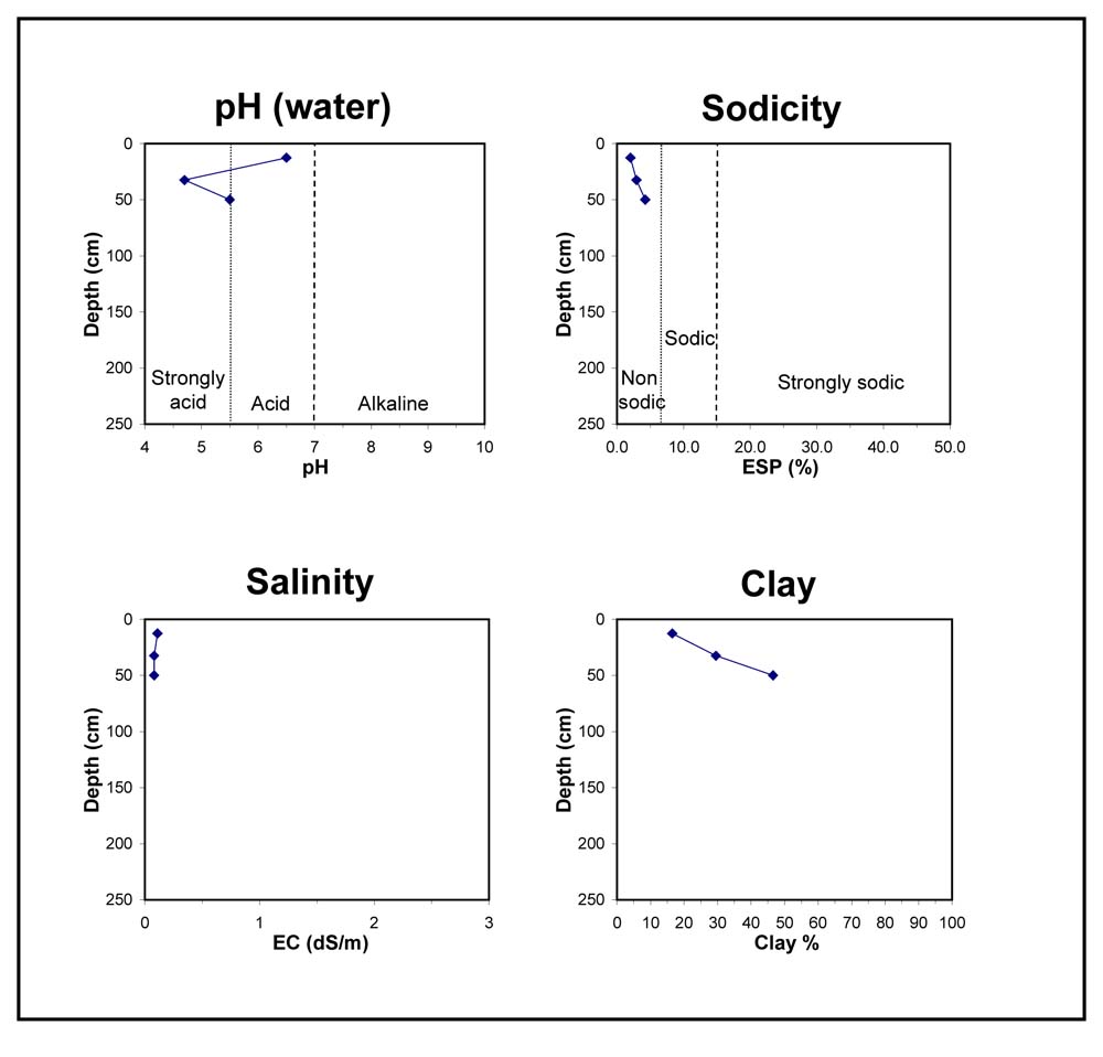
- Strongly acidic topsoil (A2)
- Acidic subsoil
- Ferruginous pan


