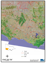
Glenelg-Hopkins Region
Welcome to the Victorian Resources Online's Glenelg-Hopkins site. This is your gateway to a wide range of resource information for the Glenelg-Hopkins catchment management region.

The Glenelg-Hopkins region covers some 27 000 square kilometres - representing about 12% of Victoria's total area.
HighlightsArarat Hills Sites of Geological & Geomorphological Significance of Private Land in the Shire of Portland Catchment-scale water and salinity impacts of changing landuse in south-western Victoria Salinity Discharge Mapping A 'virtual aerial tour' of Mt. Noorat Catchment scale impacts of land use change in south-west Victoria Related LinksGlenelg-Hopkins Catchment Management Authority website (external link) Local Governments in the Glenelg-Hopkins Region Climate in the Glenelg-Hopkins Region | Oblique aerial overview of Glenelg-Hopkins catchment management region showing major landform features and land use. |


