Your gateway to a wide range of natural resources information and associated maps

Victorian Resources Online

Reconnaissance Survey of the Middle Reaches of the Goulburn River Catchment

To view the information PDF requires the use of a PDF reader. This can be installed for free from the Adobe website (external link).

The report: Reconnaissance Survey of the Middle Reaches of the Goulburn River Catchment was edited by Larry White and published in 1990 by the former Department of Conservation and Environment. It covers the middle reaches of the Goulburn River catchment from Mansfield in the east to the junction with Hughes Creek. It provides a broad inventory of land resources in 6 700 km2 of the catchment, including accounts of the history, climate, vegetation, geomorphology, mining, water resources, soils and soil conservation practices. In addition, broad scale interpretations of land capability for a range of land uses are also presented.

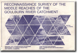


Image: Reconnaissance Survey of the Middle reaches of the Goulburn River Catchment fp
Front Page & Table of Contents (PDF 563KB)
Foreword (PDF 64KB)
Acknowledgements & List of Contributors (PDF 68KB)
Section A - Introduction
1. Background (PDF 1.1MB)
2. History (PDF 513KB)

Section B - The Landscape
3. Climate (PDF 2.1MB)
4. Water Resources & Utilisation (PDF 940KB)
5. Native Vegetation (PDF 398KB)
6. Soil Conservation (PDF 1.6MB)
7. Geology & Geomorphology (PDF 2.5MB)

Section C - Land Use
8. Agriculture (PDF 917KB)
9. Forestry (PDF 1.3MB)
10. Mining (PDF 731KB)
11. Residential Development (PDF 115KB)
12. Conservation & Recreation (PDF 590KB)

Section D - Land Inventory & Assessment
13. Land Units & Soil Descriptions (PDF 771KB)
Soil Geology Association
Land Unit Descriptions (PDF 611KB)
Land Unit Maps
14. Land Evaluation & Survey Interpretation (PDF 158KB0

Section E - Associated Information
Appendix A - Tables & associated data with Chapter 3 (PDF 531KB)
Appendix B - Major Plant Species Associated with Chapter 5 (PDF 95KB)
Appendix C - Maps & Photography used in Chapter 13 (PDF 446KB)
Appendix D - Land Capability Tables used for assessment in Chapter 14 (PDF 341KB)

References (PDF 84KB)
Page top