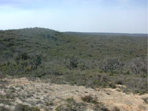
OTR606
|
| OTR606 | Melanic, Mottled-Mesonatric, Brown Sodosol | |
| Anglesea Golf Course | |||
| Undulating hills | |||
| Palaeogene Eastern View Formation, fluvial sand, gravel, clay, brown coal | |||
| Hillslope – mid slope | |||
| 0% | |||
| - | |||
Horizon | Depth (cm) | Description | ||
A1 | 0–35 | Black (10YR2/1); loamy fine sand; apedal single grain structure; clear boundary to: | ||
A2 | 35–60 | Light brownish grey (10YR6/2); loamy fine sand; apedal single grain structure; abrupt boundary to: | ||
B2 | 60+ | Dark yellowish brown (10YR4/4) with grey (10YR5/1) mottles; fine sandy clay; moderate coarse (45 mm) subangular blocky structure; hard when dry. | ||
| Management considerations | ||||
| Strong texture contrast between the surface soil and the subsoil may reduce and/or redirect the internal drainage and restricting root growth beyond the upper horizons. The sandy topsoil will likely have poor plant water holding and nutrient holding capacities that may be prone to erosion (wind, sheet and rill erosion). These soils may be hydrophobic (in conjunction with organic coatings) when dry, taking time to reabsorb moisture. The sandy topsoils however will drain rapidly. The bleached A2 horizon indicates restricted drainage, poor soil structure (often massive) and low organic matter, nutrient and water holding capacity. These bleached horizons may act as conduit for subsurface flow, particularly on sloping ground. The acidic nature of the upper horizons restricts the uptake of certain nutrients as well as intolerance for some plant species (due in part to the increasing mobilisation of aluminium and manganese). Sodic subsoils usually have poor structure (generally as coarse domed columns) resulting in dispersion (and subsequent clogging of pores), restricting water and gas movement through the subsoil. These soils are hardsetting and have limited opportunity for cultivation without further damage to soil structure. | ||||
Analytical data
Site OTR606 | Sample depth | pH | EC | NaCl | Ex Ca | Ex Mg | Ex K | Ex Na | Ex Al | Ex acidity | FC (-10kPa) | PWP (-150kPa) | KS | FS | Z | C | |
Horizon | cm | H2O | CaCl2 | dS/m | % | cmolc/kg | cmolc/kg | cmolc/kg | cmolc/kg | mg/kg | cmolc/kg | % | % | % | % | % | % |
A1 | 0-10 | 4.4 | N/R | 0.058 | N/R | 1.4 | 1.3 | 0.1 | 0.07 | N/R | N/R | N/R | N/R | 1 | 77 | 9 | 4 |
A1 | 10-20 | 4.4 | N/R | 0.052 | N/R | 0.7 | 0.9 | 0.1 | 0.07 | N/R | N/R | N/R | N/R | 1 | 80 | 9 | 4 |
A1 | 20-30 | 4.7 | N/R | 0.037 | N/R | 0.3 | 0.3 | 0.07 | 0.02 | N/R | N/R | N/R | N/R | 1 | 82 | 13 | 4 |
A2 | 50-60 | 5.5 | N/R | 0.064 | N/R | 0.2 | 0.7 | 0.1 | 0.1 | N/R | N/R | N/R | N/R | 1 | 80 | 12 | 6 |
B2 | 60-70 | 6.0 | N/R | 0.223 | N/R | 1.2 | 8.8 | 0.5 | 3.1 | N/R | N/R | N/R | N/R | 1 | 43 | 3 | 53 |
B2 | 130-140 | 7.4 | N/R | 0.300 | N/R | 0.9 | 5.0 | 0.3 | 2.5 | N/R | N/R | N/R | N/R | 1 | 59 | 5 | 33 |


