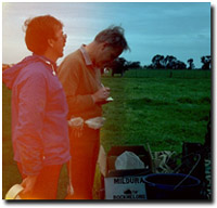
John Maher and John Martin surveying
south-west soils in the early 1980s.
|
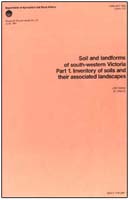
The Report: Soils and Landforms of South-Western Victoria was prepared by John Maher and John Martin and published by the former Department of Agriculture and Rural Affairs in 1987 (Research Report Series No. 40). Within 2.4 million hectares this study recognised 237 different soils using a classification scheme that is outlined in the report. A description of each of the 267 map units delineated is also provided in the report. The investigation was restricted to a uniform soil and landform survey at the field scale of 1:100 000 over the entire area.
Please note, that the more recent study "A Land Resource Assessment of the Corangamite Region" by Robinson et al. (2003) provides the most recent overview of the soils and landforms in the Corangamite region. This study utilises the Maher and Martin (1987) report as well as remote sensing information and additional field work to develop an updated 1:100 000 scale soil/landform mapping coverage across the region. |


