
Soil/Landform Unit - Servicetown North limestone rises
Landform Unit Description
Page top
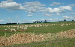 Limestone rises near Servicetown cleared and used as pastoral runs |
0.02% of CMA region This unit of low to moderate relative relief terrain of plains and rises consists of a single small occurrence north of Serviceton, on the South Australian border. Part of the North West Dunefields and Plains, these plains and rises are associated with Neogene Parilla Sand deposits, but have a calcareous (limestone) component also. Bound by ridge and plain terrain (Kiata, Woorak and Lorquon units), the main landforms include plains rise slopes and rise crests. Little surface expression of drainage exists on the level to gently undulating plain. Soils including grey cracking clay soil (Vertosols) which may be self-mulching and sodic occur on plains, with calcareous red texture contrast soil (Calcarosols) on the rises. Sheet and rill erosion are more applicable to the rises with hardsetting surfaces. Used mainly for dryland cropping with some grazing (sheep), remnant vegetation communities include Low Rises Woodland, Ridged Plains Mallee and Shallow Sands Woodland. | 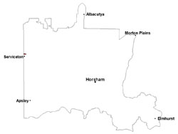 |
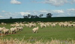
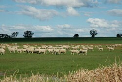 Sheep grazing on a lower slope of a limestone rise | 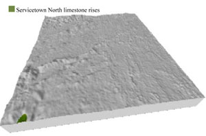 |
 |  Rise slope near Servicetown |
Component | 1 | 2 | 3 |
Proportion of soil-landform unit | 5% | 20% | 75% |
| CLIMATE Rainfall (mm) | Annual: | ||
| Temperature (oC) | Minimum 8, Maximum22 | ||
| Precipitation less than potential evapotranspiration | September–April | ||
| GEOLOGY Age and lithology | Neogene marine sand and silt (Parilla Sand) | ||
| Geomorphology | |||
| LANDUSE | Uncleared areas: nature conservation Cleared areas: dryland cropping; sheep grazing | ||
| TOPOGRAPHY Landscape | Limestone rises | ||
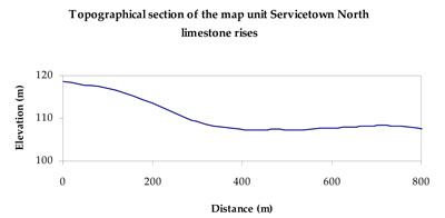
| Elevation range (m) | 104–120 | ||
| Local relief (m) | 10–15 | ||
| Drainage pattern | Dendritic | ||
| Drainage density (km/km2) | 0.5 | ||
| Landform | Rises | ||
| Landform element | Rise crest | Rise slope | Plain |
| Slope and range (%) | 3 (1-7) | 5 (3-10) | 3 (1-8) |
| Slope shape | Convex | Convex | Concave |
| NATIVE VEGETATION Ecological Vegetation Class | Low Rises Woodland (62.5%), Shallow Sands Woodland (20.8%), Ridged Plains Mallee (8.3%) | ||
| SOIL Parent material | Marine sand and silt, minor aeolian sand | Marine sand and silt, minor aeolian sand | Marine sand and silt, minor aeolian sand |
| Description (Corangamite Soil Group) | Sodic red texture contrast soils (35) | Sodic red texture contrast soils (35) | Grey and brown cracking clay soils (37) |
| Soil type sites | LS3, LSWW9, LSWW5 | ||
| Surface texture | Sandy clay loam | Sandy clay loam | Medium clay |
| Permeability | Moderate | Moderate | Slow |
| Depth (m) | 1.6 | 2 | > 2 |
| LAND CHARACTERISTICS, POTENTIAL AND LIMITATIONS Critical land features, processes, forms | Hardsetting soil surface susceptible to sheet and rill erosion, and wind erosion where exposed. Dispersive and deep subsoils susceptible to gully erosion on steeper slopes. | Hardsetting soil surface susceptible to sheet and rill erosion, and wind erosion where exposed. Dispersive and deep subsoils susceptible to gully erosion where exposed. Compaction of soil dependent upon depth of force and moisture content. | Susceptible to inundation and waterlogging in low-lying areas. Surface soils friable and only slightly susceptible to wind erosion. Soils susceptible to compaction at critical moisture contents. |
© State of Victoria (Agriculture Victoria) 1996 - .

This work, Victorian Resources Online, is licensed under a Creative Commons Attribution 4.0 licence. You are free to re-use the work under that licence, on the condition that you credit the State of Victoria (Agriculture Victoria) as author, indicate if changes were made and comply with the other licence terms.
The licence does not apply to ‘branding’ or some ‘images or photographs’ that may be owned by third parties. We ask you to seek prior approval to use images using the VRO feedback form. Access to higher quality images can also be provided on request.
This page was last updated on .