
Soil/Landform Unit - Riverside level plains
Landform Unit Description
Page top
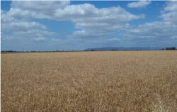 Cereal cropping on level plains east of Horsham (Grampians Ranges in the distance) |
0.01% of CMA region Just east of Horsham, this plain (flat) complex is part of the Northern Riverine Plains older alluvial plains without leveed channels geomorphology division. These flats and very gently undulating slopes of Quaternary alluvial sediments occur within the older alluvial plains of the Wimmera River and associated units (Corkers, Wimmera River, Drung). There are two components with the flats being dominant. The other component is the gentle plain slopes. Drainage is very slow given the level plain topography. Soil types are predominantly grey cracking clay soils (Vertosols) that are generally sodic. Inundation and waterlogging are the major land degradation susceptibilities for this unit given the flat topography and heavy soils, which will only drain until the clay swells. Wind, sheet and rill erosion, and soil compaction are minor land degradation susceptibilities for this unit given the heavy soils. These units are used for dryland cropping as well as grazing (sheep and beef cattle). Remnant vegetation is largely the Riverine Chenopod Woodland vegetation community. | 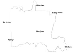 |
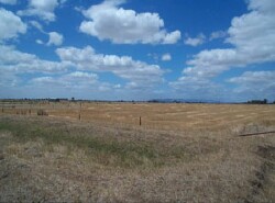 Level plains within the Horsham irrigation settlement | 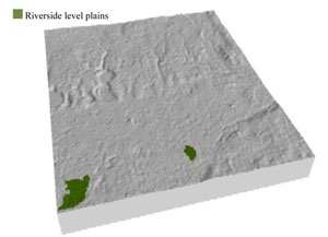 |
 | 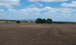 Looking south towards the Grampians over the level plains near Jung |
Component | 1 | 2 |
Proportion of soil-landform unit | 80% | 20% |
| CLIMATE Rainfall (mm) | Annual: 480 | |
| Temperature (oC) | Minimum 8, Maximum 21 | |
| Precipitation less than potential evapotranspiration | September–April | |
| GEOLOGY Age and lithology | Quaternary fluvial gravel, sand and silt | |
| Geomorphology | ||
| LANDUSE | Uncleared areas: nature conservation; residential development Cleared areas: dryland cropping; sheep grazing; residential development | |
| TOPOGRAPHY Landscape | Level plains | |
| Elevation range (m) | 126–133 | |
| Local relief (m) | 0–1 | |
| Drainage pattern | Dendritic | |
| Drainage density (km/km2) | 0.8 | |
| Landform | Plains | |
| Landform element | Flat | Gentle slope |
| Slope and range (%) | 0 (0-1) | 1 (0-3) |
| Slope shape | Straight | Linear |
| NATIVE VEGETATION Ecological Vegetation Class | Riverine Chenopod Woodland (61.2%) | |
| SOIL Parent material | Alluvial sand and silt, minor gravel | Alluvial sand and silt, minor gravel |
| Description (Corangamite Soil Group) | Cracking and self-mulching clay soils (24) | Cracking and self-mulching clay soils (24) |
| Soil type sites | ||
| Surface texture | Medium clay | Medium clay |
| Permeability | Slow to very slow | Slow |
| Depth (m) | > 3 | > 3 |
| LAND CHARACTERISTICS, POTENTIAL AND LIMITATIONS Critical land features, processes, forms | Flat areas, susceptible to inundation and waterlogging along with flooding. Surface soils friable and only slightly susceptible to wind erosion. Soils may be susceptible to compaction at critical moisture contents. | Gentle slopes susceptible to waterlogging, but can be variable due to micro relief (gilgai). Surface soils friable and only slightly susceptible to wind erosion. Soils may be susceptible to compaction at critical moisture contents. |
© State of Victoria (Agriculture Victoria) 1996 - .

This work, Victorian Resources Online, is licensed under a Creative Commons Attribution 4.0 licence. You are free to re-use the work under that licence, on the condition that you credit the State of Victoria (Agriculture Victoria) as author, indicate if changes were made and comply with the other licence terms.
The licence does not apply to ‘branding’ or some ‘images or photographs’ that may be owned by third parties. We ask you to seek prior approval to use images using the VRO feedback form. Access to higher quality images can also be provided on request.
This page was last updated on .