
Soil/Landform Unit - Big Desert dense dunes
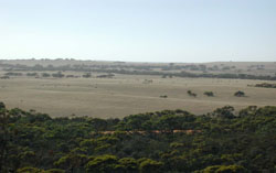 Cleared dunefields of the Big Desert with a rolling topography of dense dunes |
4.25% of CMA region The Big Desert is a feature of national significance owing to its diversity of native flora and fauna, as well as its genesis and geomorphic character of today. Comprising a suite of various dune formations, these dense dunes (along with jumbled dunes) comprise fine aeolian sands that have migrated along the west-east axis of the prevailing wind direction. The siliceousdunes of Lowan Sand are closely spaced with relief generally less than 10 m with narrow sandy swales. Vegetation communities such as Lowan Sands Mallee, Heathy Mallee and Loamy Sands Mallee are common making these dunes more stable than those of the jumbled dunes. Lining the north-western extent of the Wimmera CMA region, soils comprise sandy soils with and without pans, and sodic yellow and grey texture contrast soils especially in swales. Soils have a very low inherent soil fertility owing to their high sand content, and also are extremely vulnerable to wind erosion where ground coverage is insufficient. | 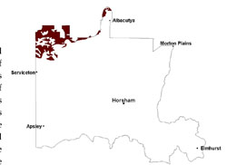 |
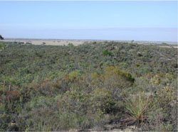 Remnant vegetation on uncleared dune slopes | 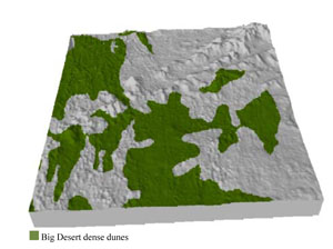 |
|
|

Component | 1 | 2 | 3 |
Proportion of soil-landform unit | 5% | 55% | 40% |
| CLIMATE Rainfall (mm) | Annual: 400 | ||
| Temperature (oC) | Minimum 8, Maximum 22 | ||
| Precipitation less than potential evapotranspiration | September–April | ||
| GEOLOGY Age and lithology | Quaternary aeolian dune sand (Lowan Sand); Neogene marine sand and silt (Parilla Sand) | ||
| Geomorphology | 5.2.2 Linear dunes of the Siliceous North West Dunefields and Plains | ||
| LANDUSE | Uncleared areas: nature conservation; recreational activities Cleared areas: dryland cropping; sheep grazing; native vegetation plantation/harvesting (e.g. broombush) | ||
| TOPOGRAPHY Landscape | Dense linear dunes | ||
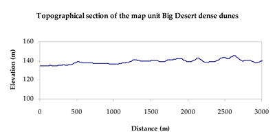
| Elevation range (m) | 71–175 | ||
| Local relief (m) | 7–8 | ||
| Drainage pattern | Parallel | ||
| Drainage density (km/km2) | Nil | ||
| Landform | Dunefields | ||
| Landform element | Dune crest | Dune slope | Sand plain |
| Slope and range (%) | 3 (1-7) | 5 (3-10) | 3 (1-8) |
| Slope shape | Convex | Concave | Concave |
| NATIVE VEGETATION Ecological Vegetation Class | Lowan Sands Mallee (48.2%), Sandstone Ridge Shrubland (22.4%), Heathy Mallee (12.8%), Shallow Sands Woodland (8.1%), Other (3.3%) | ||
| SOIL Parent material | Aeolian sand | Aeolian sand | Aeolian sand and silt |
| Description (Corangamite Soil Group) | Sandy soils with and without pans (31) | Sodic yellow and grey texture contrast soils (32) | |
| Soil type sites | LSWW8, LSWW7, WIA24 | ||
| Surface texture | Sand | Sand | Loamy sand |
| Permeability | High | High | Moderate |
| Depth (m) | > 1.5 | > 1.5 | > 1.5 |
| LAND CHARACTERISTICS, POTENTIAL AND LIMITATIONS Critical land features, processes, forms | Soils with low organic matter levels can be susceptible to wind and sheet erosion where exposed. Low inherent soil fertility. | Soils with low organic matter levels that are highly susceptible to wind and sheet erosion where exposed. Low inherent soil fertility. | Susceptible to wind and sheet erosion where exposed. Low inherent fertility but well drained to pans or subsoil. Susceptible to compaction where hardsettingand poor drainage occurs. |
© State of Victoria (Agriculture Victoria) 1996 - .

This work, Victorian Resources Online, is licensed under a Creative Commons Attribution 4.0 licence. You are free to re-use the work under that licence, on the condition that you credit the State of Victoria (Agriculture Victoria) as author, indicate if changes were made and comply with the other licence terms.
The licence does not apply to ‘branding’ or some ‘images or photographs’ that may be owned by third parties. We ask you to seek prior approval to use images using the VRO feedback form. Access to higher quality images can also be provided on request.
This page was last updated on .