
Northern Victorian Focus Catchments
(PDF 2.5MB)
To view the information PDF requires the use of a PDF reader. This can be installed for free from the Adobe website (external link).
Background
The Victorian Government is committed to managing water resources to support a thriving economy, healthy environment and growing communities (Victorian Government White Paper: Securing Our Water Future Together), and DPI is supporting this commitment through Future Farming Strategy Action 4 'Strengthening land and water management'.
In order to manage our water resources there is a need to understand how climate change and land use change impact on Victoria's water resources. This project will investigate the role of surface and groundwater systems in the Goulburn and Ovens river catchments - in particular, how they respond to changing land use and climate conditions, the rivers' connection to landscapes and interactions between surface and groundwater systems.
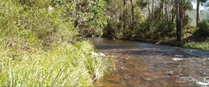
The Focus Catchments
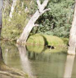
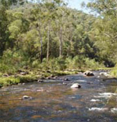
The Ovens and Goulburn rivers contribute significantly to the water resources of the Murray-Darling Basin. These two rivers are similar in many ways in terms of their geomorphology, land use, and vegetation communities, but the Ovens River is largely unregulated while the Goulburn is highly regulated.
Both rivers have high environmental value and natural biodiversity. Irrigated and dryland agriculture are very important in both catchments, and contribute significantly to the Victorian and national economies.
In their natural state, both rivers’ off-channel floodplain wetlands, red gum forests, and other ecosystems would be strongly influenced by seasonal flooding. Although the Ovens River still floods frequently, the Goulburn River, regulated by Eildon Dam, does not. This project is investigating how potential flow scenarios and the management of environmental flows could affect river and floodplain ecology.
 |  |
| The Goulburn River The Goulburn River catchment in central Victoria covers 16,192 km2 and extends from the Great Dividing Range near Woods Point, to the Murray River in the north-west near Echuca. Agriculture in the catchment is diverse, ranging from hardwood timber production in the south-east to dairying and fruit production in the north. The Lake Eildon environs produce sheep for wool, and beef and dairy cattle. Further along the Goulburn Valley, sheep and cropping are important in dryland and irrigated areas. The Shepparton Irrigation Region is a significant dairying centre and the region is also well known for its pome and stone fruit production. Streamflow along the Goulburn River has been modified by two major features, Lake Eildon and the Goulburn Weir. Lake Eildon, just below the junction of the Goulburn and Delatite rivers, has a capacity of 3300 GL. On average 91% of the water released from Lake Eildon is used for irrigation purposes. Operation of the Eildon Reservoir has reduced the July to September flows passing Eildon to 33 percent of the mean seasonal flow, allowing an increase of the January to March flows of 23 percent. The Goulburn Weir near Nagambie and associated diversion channels to the east and west of the river, serving the Goulburn-Murray Irrigation District, have reduced the average annual down river flow to less than half the pre-regulated flow. | 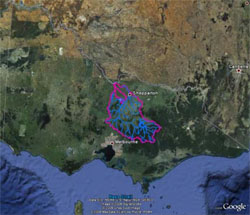 |
| The Ovens River The Ovens River is the only largely unregulated catchment of the Murray. It has a high ecological significance, with parts of the Ovens nominated under the Heritage Rivers Act 1992 in recognition of the many significant features of these areas. The Ovens River catchment is 7,985 km2 which extends from the Murray River in the north, to the Great Dividing Range in the south. The catchment is diverse ranging from riverine plains near the Murray River and broad alluvial valleys around Myrtleford, to rugged alpine peaks and plateaux around the Great Dividing Range. Mt Buffalo, a large granite mass in the south of the basin, is an important landscape feature. While the Ovens River is largely unregulated, there are two small water impoundments at Lake Buffalo and Lake William Hovell with a combined capacity of 37.5 GL. There are a range of land uses within the catchment including livestock production (sheep for meat and wool, beef cattle and some dairying) and horticultural production (traditionally tobacco, but now hops and vineyards). In the central and south-eastern regions of the Basin, hardwood logging and forest grazing are important. | 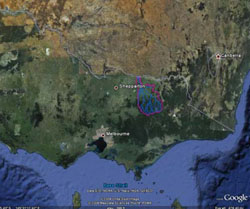 |
 | Key Contact Kirsten Barlow (02) 6030 4500 kirsten.barlow@dpi.vic.gov.au |
© State of Victoria (Agriculture Victoria) 1996 - .

This work, Victorian Resources Online, is licensed under a Creative Commons Attribution 4.0 licence. You are free to re-use the work under that licence, on the condition that you credit the State of Victoria (Agriculture Victoria) as author, indicate if changes were made and comply with the other licence terms.
The licence does not apply to ‘branding’ or some ‘images or photographs’ that may be owned by third parties. We ask you to seek prior approval to use images using the VRO feedback form. Access to higher quality images can also be provided on request.
This page was last updated on .