
EGS264
Location: Wiseleigh
Australian Soil Classification: Melacic, Magnesic (and Dystrophic), Brown CHROMOSOL
Map Unit: Tambo (Component 2)
Previous Site Name: EG264
General Landscape Description: Gently undulating plain.
Site Description: Mid south slope, 17% slope
Land Use: Grazing
Native Vegetation: Grassy woodland
Geology: Ordovician sediments
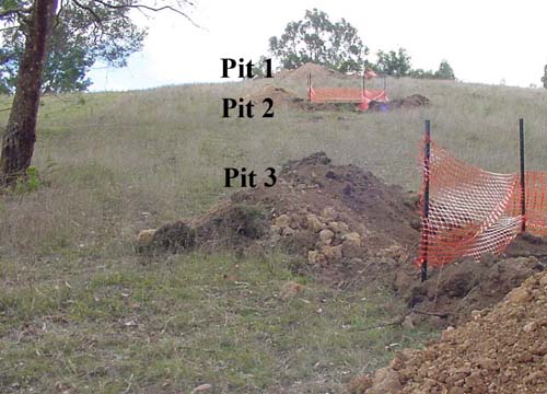
Sequence of soil pits examined at Wiseleigh
Soil Profile Morphology:
Surface Soil
| A11 | 0 – 8 cm | Very dark grey (7.5YR3/1); loam; strong fine granulars structure; firm consistence dry; abrupt change to: | 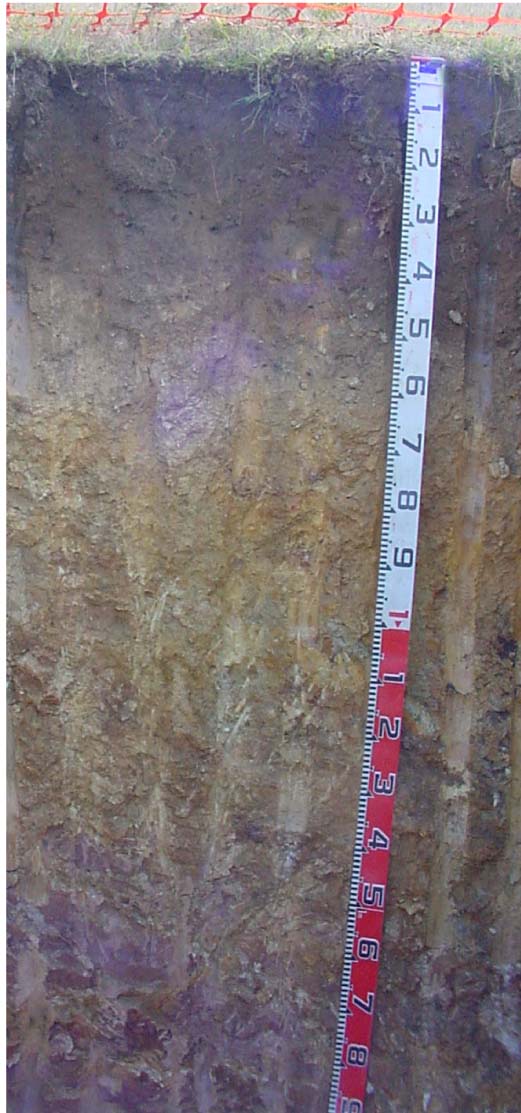 EG264 Profile |
| A12 | 8 – 35 cm | Very dark grey (7.5YR3/1); clay loam; weak fine angular blocky structure; firm consistence dry ; clear change to: | |
| Subsoil | |||
| B21 | 35 – 50 cm | Brown (7.5YR5/4) medium clay; moderate coarse (50 -100 mm) prismatic structure; firm consistence dry; few (2 – 10%) angular pebbles (< 60 mm); gradual change to: | |
| B22 | 50 – 70 cm | Light brown (7.5YR6/4); light clay; moderate coarse (50 - 100 mm) prismatic structure; very firm consistence dry; few (2 – 10%) angular pebbles (< 60 mm); gradual change to: | |
| C | 70 – 100 cm | Mottled yellow (10YR7/6) and reddish yellow (5YR6/6); light clay; strong medium (10 – 20 mm) polyhedralstructure; very firm consistence dry; diffuse change to: | |
| R | 100 cm+ | Weak decomposing rock |
Key Profile Features:
- Texture contrast between the surface (A) horizons and the subsoil (B horizons).
- Very high organic matter in the surface soil, which enhances nutrient and water-holding capacity.
Soil Profile Characteristics:
| Sodicity | |||
Surface soil (A11) | Very strongly acid | Non-sodic | - |
Subsoil (B21 horizon) | Moderately acid | Non-sodic | None |
Deep subsoil (C horizon) | Slightly acid | Sodic | Slight1 |
Chemical and Physical Analysis:
Horizon | Horizon Depth (cm) | pH (water) | pH CaCl2 | CE dS/m | Organic Carbon % | Total Nitrogen % | Exch. Al | Exch. Acididty meq/100g | Exchangeable Cations | Coarse Sand (0.2-2.0 mm) % | Fine Sand (0.02-0.2 mm) % | Silt (0.002-0.02 mm) % | Clay (<0.002 mm) % | Field cap. % w/w | Wilt. point % w/w | |||
Ca | Mg | K | Na | |||||||||||||||
meq/100g | ||||||||||||||||||
A11 | 0-8 | 4.9 | 4.2 | 0.12 | 11 | 0.59 | 360 | 18 | 3.4 | 3.2 | 0.9 | 0.1 | 24 | 23 | 19 | 19 | 53.1 | 30 |
A12 | 8-35 | 5.0 | 4.3 | <0.05 | 5.3 | 0.22 | 460 | 20 | 0.2 | 0.7 | 0.2 | .1 | 17 | 24 | 23 | 28 | 53.0 | 15.2 |
B21 | 35-50 | 5.8 | 4.7 | <0.05 | 140 | 13 | <0.1 | 0.7 | 0.2 | 0.1 | 18 | 22 | 13 | 44 | 34.4 | 14.1 | ||
B22 | 50-70 | 5.8 | 4.7 | <0.05 | 82 | 6.1 | <0.1 | 0.7 | 0.1 | <0.1 | 22 | 21 | 27 | 28 | 29.3 | 12.4 | ||
C | 70-100 | 6 | 4.6 | <0.05 | 55 | 4.2 | <0.1 | 1.3 | 0.2 | 0.2 | 8 | 16 | 46 | 29 | 35.5 | 14.7 | ||
Management Considerations
Whole profile
- Based on a plant root depth of 50 cm, the plant available water capacity is about 62 mm.
- Texture contrast between the surface (A horizons) and the subsoil (B horizon).
Surface (A) horizons
- The surface (A11) horizon has a particularly high organic matter content which has greatly added to the nutrient holding and water holding capacity of the soil. By contrast the subsurface soil (A12) horizon has a very low nutrient holding capacity.
- The surface soil is very strongly acidic and the very high levels of exchangeable aluminium are likely to restrict the growth of aluminium sensitive species. A response to lime would be expected, but before it is applied, test strips should be used to evaluate the cost/benefit.
Subsoil (B and C) horizons
- All of these horizons have a very low nutrient holding capacity (based on the sum of the calcium, magnesium, potassium and sodium cations).
- The deep subsoil (C horizon) is sodic and shows moderate dispersion after 20 hours of wetting. Such a soil would be prone to tunnel and gully erosion.
Profile Described By: Ian Sargeant (2011).
© State of Victoria (Agriculture Victoria) 1996 - .

This work, Victorian Resources Online, is licensed under a Creative Commons Attribution 4.0 licence. You are free to re-use the work under that licence, on the condition that you credit the State of Victoria (Agriculture Victoria) as author, indicate if changes were made and comply with the other licence terms.
The licence does not apply to ‘branding’ or some ‘images or photographs’ that may be owned by third parties. We ask you to seek prior approval to use images using the VRO feedback form. Access to higher quality images can also be provided on request.
This page was last updated on .