
Drainage line (Symbol: dr)
Geology
Holocene and Pleistocene alluvium
Landform
Level plain with slopes generally less than 1% with a relief <9m.
Terraced alluvial floors at low elevation, comprising flood plains, older alluvial terraces and alluvial fans, stream channels.
In the present area this unit is limited to the Dargo and Wonnangatta River valleys.
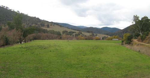
Dargo valley flood plain near Dargo
Original vegetation:
Dry valley forest
Soils
Most of the soils of this map unit occur on the flood plains. Generally they are dark greyish brown deep fine sandy to silty loams and clay loams, but layers of coarser material such and stones and gravel may occur deeper in the subsoil. Parts of these valleys may have been dredged for gold bringing the stones to the surface.
© State of Victoria (Agriculture Victoria) 1996 - .

This work, Victorian Resources Online, is licensed under a Creative Commons Attribution 4.0 licence. You are free to re-use the work under that licence, on the condition that you credit the State of Victoria (Agriculture Victoria) as author, indicate if changes were made and comply with the other licence terms.
The licence does not apply to ‘branding’ or some ‘images or photographs’ that may be owned by third parties. We ask you to seek prior approval to use images using the VRO feedback form. Access to higher quality images can also be provided on request.
This page was last updated on .