
Calulu (Symbol: Cu)
Profile No. 13 (Aldrick et al 1992)
Geology
Complex of Neogene limestone (Miocene) and alluvial sediments (Pleistocene)
Landform
Valley slopes up to 32%. This map unit is quite minor in extent and is confined to the steep valley sides of the minor watercourses and streams entering the northern parts of the Mitchell River near Bairnsdale.
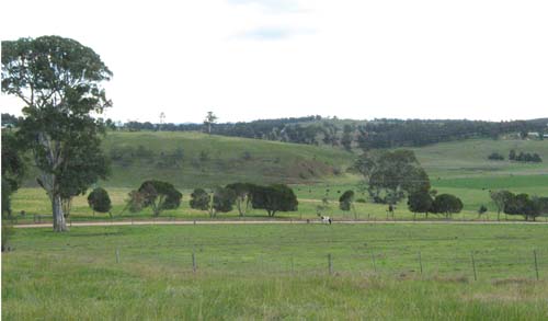
Original vegetation
Dry valley forest
Soils
The soils are quite variable. Those on limestone are red brown light to medium clays with lime and quartz fragments in the upper parts of the profile. Those not on limestone are likely to be clayey soils with variable quantities of gravel to rounded stones.
Profile No. 13 (Aldrick et al 1992)
| Location: Wy Yung | Geo. Ref.: 555800E 5815800N |
| Australian Soil Classification: Haplic, Lithocalcic, Red DERMOSOL | Gradational red soil on limestone |
| Site description: Midslope of a low hill, 14% slope | |
| Map unit: Calulu |
| Depth cm | Colour | Texture | pH | TSS % | Grv % | CS % | FS % | Silt % | Clay % | Org C % | Tot N % | Exchangeable cations cmol(+)/kg | Ca:Mg | ESP | ||||
| Ca | Mg | K | Na | CEC | ||||||||||||||
| 0-10 | Dark reddish brown | LC | 6.3 | 0.04 | 2 | 7 | 37 | 14 | 38 | 4.8 | .37 | 15.9 | 2.3 | 1.3 | 0.2 | 31.8 | 7 | 0 |
| 30-60 | Red | HC | 6.8 | 0.02 | 4 | 2 | 8 | 3 | 86 | 27.3 | 1.8 | 0.5 | 0.5 | 44.6 | 15 | 1 | ||
| 80-90 | Red | MC | 7.5 | 0.06 | 6 | 7 | 10 | 9 | 72 | 29.7 | 1.3 | 0.4 | 0.4 | 37.8 | 24 | 1 | ||
Note: Photo of profile and landscape not available.
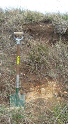
Roadside cutting on the Wy Yung Calulu Road near Calulu
© State of Victoria (Agriculture Victoria) 1996 - .

This work, Victorian Resources Online, is licensed under a Creative Commons Attribution 4.0 licence. You are free to re-use the work under that licence, on the condition that you credit the State of Victoria (Agriculture Victoria) as author, indicate if changes were made and comply with the other licence terms.
The licence does not apply to ‘branding’ or some ‘images or photographs’ that may be owned by third parties. We ask you to seek prior approval to use images using the VRO feedback form. Access to higher quality images can also be provided on request.
This page was last updated on .