
GL23 (8422) Point Turner - Banksia Peninsula
|
This information has been developed from the publications:
|
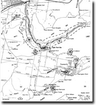
| Location: | 650993 (8422). Northern shore of Lake Victoria, 8 kilometres south of Eagle Point. | |
Abstract: | Cuspate spit; exposures of prior barrier sands and gravels. | |
Access: | Lake Victoria Road. | |
Ownership: | Private land. | |
Geology: | Pleistocene sands and gravels, Holocene sands. | |
Geomorphology: | Banksia Peninsula is a remnant of the prior barrier, the earliest barrier system identified in the Gippsland Lakes basin. The surface consists of low, widely spaced ridges of sand and gravel, the swales between the ridges being 1 to 2 metres above the calm-weather level of Lake Victoria. A cliffed section exposed by wave erosion on the eastern shoreline of Banksia Peninsula displays coarse cross-bedded sands and pebbles overlain by bedded gravels. The lower part of the sequence may be in part a deltaic deposit that has been surmounted by beach ridge accumulations of the prior barrier, the coarser sediments being derived from erosion of the Haunted Hill Gravels deposits to the adjacent marginal bluff. | |
Significance: | As with other prior barrier remnants in the Lakes, the original form of the barrier at Banksia Peninsula has been modified by later processes. Dissection by streams at lower sea level times has reduced the area of the barrier, and since the formation of the inner barriers, waves and parallel ridges such as at Point Turner. The newer accretion ridges from these differ from those of the prior barrier by their closer spacing and the absence of a soil horizon or deep weathering and leaching features. | |
Management: | State. The cliffed shoreline near Point Turner is the best example of the composition and form of the prior barrier exposed in the Gippsland Lakes. | |
Cliff erosion may pose a threat to private property with resulting demands for cliff stabilization. In the interests of preserving the section, permits should not be issued for buildings or construction that may be endangered by cliff recession. | ||
References: | Bird, E.C.F. (1978). The Geomorphology of the Gippsland Lakes Region. Publication No. 186, Environmental Studies Series, Ministry for Conservation, Victoria. | |
© State of Victoria (Agriculture Victoria) 1996 - 2025.

This work, Victorian Resources Online, is licensed under a Creative Commons Attribution 4.0 licence. You are free to re-use the work under that licence, on the condition that you credit the State of Victoria (Agriculture Victoria) as author, indicate if changes were made and comply with the other licence terms.
The licence does not apply to ‘branding’ or some ‘images or photographs’ that may be owned by third parties. We ask you to seek prior approval to use images using the VRO feedback form. Access to higher quality images can also be provided on request.
This page was last updated on 23/03/2020.