
Soil/Landform Unit 35
Landform Unit Description
Page top
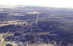 The low eruption poin occurs at Scarsdale, south of Smythesdale |
<0.01% of CMA region The relatively steep eruption point in the Scarsdale area is a relatively minor eruption point of the Western Plains. This eruption point has steep rocky slopes and crest. The soils are shallow, red or black loamy soils. These well structured red or black soils have a high inherent fertility and water holding capacity. Local relief of this eruption point is 35 m with no developed drainage network. The vegetation class Plains Grassy Woodland is significant for this small unit. The land use is confined to grazing (mainly sheep) owing to the steepness and rocky nature of slopes. Land degradation issues include rapid overland flow from steep slopes and sheet and rill erosion. | 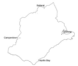 |
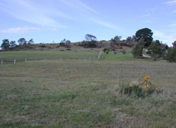 Western slopes of the low cone at Scarsdale | 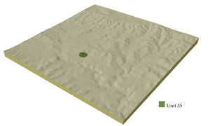 |
|
Component | 1 | 2 | 3 |
Proportion of soil-landform unit | 30% | 20% | 50% |
| CLIMATE Rainfall (mm) | Annual: 670 | ||
| Temperature (oC) | Minimum 7, Maximum 18 | ||
| Precipitation less than potential evapotranspiration | October-April | ||
| GEOLOGY Age and lithology | Quaternary basalt | ||
| Geomorphology | |||
| LANDUSE | Uncleared areas: Nature conservation Cleared areas: Sheep and beef cattle grazing; cropping (cereal) | ||
| TOPOGRAPHY Landscape | Eruption point with steep rocky slopes | ||
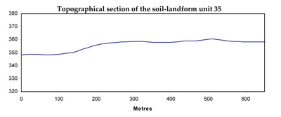
| Elevation range (m) | 345-380 | ||
| Local relief (m) | 35 | ||
| Drainage pattern | - | ||
| Drainage density (km/km2) | 1.1 | ||
| Landform | Cone | ||
| Landform element | Rocky crest and upper slopes | Steep rocky mid slopes | Lower slopes |
| Slope and range (%) | 6 (1-15) | 15 (10-32) | 8 (5-15) |
| Slope shape | Convex | Irregular | Concave |
| NATIVE VEGETATION Ecological Vegetation Class | Plains Grassy Woodland (13.6%) | ||
| SOIL Parent material | Scoria and basalt | Scoria and basalt | Scoria and basalt |
| Description (Corangamite Soil Group) | Shallow red or blacky loam soils (40) | Shallow red or blacky loam soils (40) | Shallow red or blacky loam soils (40) |
| Soil type sites | |||
| Surface texture | Loam | Clay loam | Clay loam |
| Permeability | Very high | High | High |
| <0.6Depth (m) | <0.7 | <1 | |
| LAND CHARACTERISTICS, POTENTIAL AND LIMITATIONS | Loam (heavy) soils, shallow and friable. Low to moderate water holding capacity, moderate to high nutrient holding capacity. Often stony. Moderately rapid site drainage with slight susceptibility to sheet erosion. | Loam (heavy) soils, shallow and friable. Low to moderate water holding capacity, moderate to high nutrient holding capacity. Often stony. Rapid site drainage with slight susceptibility to sheet erosion. | Loam (heavy) soils, shallow and friable. Low to moderate water holding capacity, moderate to high nutrient holding capacity. Often stony. Moderately rapid site drainage with slight susceptibility to sheet erosion. |
© State of Victoria (Agriculture Victoria) 1996 - .

This work, Victorian Resources Online, is licensed under a Creative Commons Attribution 4.0 licence. You are free to re-use the work under that licence, on the condition that you credit the State of Victoria (Agriculture Victoria) as author, indicate if changes were made and comply with the other licence terms.
The licence does not apply to ‘branding’ or some ‘images or photographs’ that may be owned by third parties. We ask you to seek prior approval to use images using the VRO feedback form. Access to higher quality images can also be provided on request.
This page was last updated on .