
Soil/Landform Unit 152
Landform Unit Description
Page top
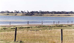
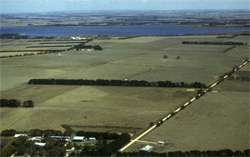 The undulating ridge (lunette) of Lake Modewarre is located on the eastern shore of the lake (closest). This lunette supports cereal cropping on its rich black self-mulching clays |
0.02% of CMA region The undulating ridge along the eastern shore of Lake Modewarre represents one of many lunettes across the volcanic Western Plains. Lake Modewarre is located south of the Princes Highway near Buckley. The lake provides a water body and wetland for a variety of birds, plants and other invertebrates. Little remnant vegetation occurs on the ridge (less than 0.5%) with the major vegetation class being Plains Grassy Woodland. The undulating ridge has highly fertile deep black self-mulching soils on the slopes and crest. Cereal production is a prominent land use. These expansive clay soils are strongly structured with moderate site drainage. Subsoils are likely to be calcareous and sodic with depth. | 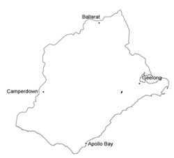 |
 Undulating ridge (lunette) on the south-eastern edge of Lake Modewarre | 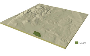 |
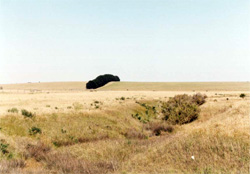
 |  Quaternary basalt at northern end of Lake Modewarre |
Component | 1 | 2 | 3 |
Proportion of soil-landform unit | 20% | 30% | 50% |
| CLIMATE Rainfall (mm) | Annual: 650 | ||
| Temperature (oC) | Minimum 9, Maximum 19 | ||
| Precipitation less than potential evapotranspiration | October-April | ||
| GEOLOGY Age and lithology | |||
| Geomorphology | |||
| LANDUSE | Unclared: Water supply catchment; nature conservation (remnants bordering Lake Modewarre) Cleared: Sheep and cattle grazing; cropping | ||
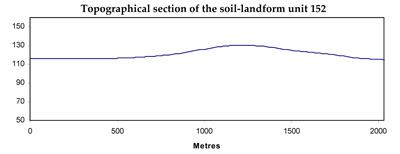
| TOPOGRAPHY Landscape | Undulating ridge (lunette) along the eastern shore of Lake Modewarre | ||
| Elevation range (m) | 116-131 | ||
| Local relief (m) | 15 | ||
| Drainage pattern | Dendritic | ||
| Drainage density (km/km2) | 2.4 | ||
| Landform | Ridge | ||
| Landform element | Crest | Upper slope | Lower slope |
| Slope and range (%) | 2 (1-4) | 10 (5-20) | 5 (3-10) |
| Slope shape | Convex | Convex | Concave |
| NATIVE VEGETATION Ecological Vegetation Class | Plains Grassy Woodland (0.2%) | ||
| SOIL Parent material | Clay, silt and sand | Clay, silt and sand | Clay, silt and sand |
| Description (Corangamite Soil Group) | Alkaline black self-mulching clays (9) | Alkaline black self-mulching clays (9) | Alkaline black self-mulching clays (9) |
| Soil type sites | |||
| Surface texture | Light clay | Light clay | Light clay |
| Permeability | Moderate to high | Moderate | Moderate to low |
| Depth (m) | >2 | >2 | >2 |
| LAND CHARACTERISTICS, POTENTIAL AND LIMITATIONS | Expansive clay soil, strongly structured, fine in upper soil (self-mulching) coarser with depth. Moderately rapid site drainage. Probably sodic and calareous in subsoil particularly with depth. | Expansive clay soil, strongly structured, fine in upper soil (self-mulching) coarser with depth. Rapid site drainage. Probably sodic and calcareous in subsoil particularly with depth. | Expansive clay soil, strongly structure, fine in upper soil (self-mulching) coarser with depth. Moderate site drainage. Probably sodic and calcareous in subsoil particularly with depth. |
© State of Victoria (Agriculture Victoria) 1996 - .

This work, Victorian Resources Online, is licensed under a Creative Commons Attribution 4.0 licence. You are free to re-use the work under that licence, on the condition that you credit the State of Victoria (Agriculture Victoria) as author, indicate if changes were made and comply with the other licence terms.
The licence does not apply to ‘branding’ or some ‘images or photographs’ that may be owned by third parties. We ask you to seek prior approval to use images using the VRO feedback form. Access to higher quality images can also be provided on request.
This page was last updated on .