
Wimmera Geomorphology
See also Victoria's Geomorphological Framework
|
The Geomorphology Reference Group (GRG) was established in 1995 by a group of interested parties with the aim of reviewing the Geomorphic Division of Victoria, primarily as a framework for the evolving Statewide Land Systems and contributing studies. The following map has been developed as part of the development of the new geomorphological framework for Victoria.
| 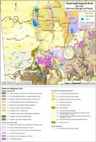 Wimmera Geomorphic Units (PDF 903KB) To view the information PDF requires the use of a PDF reader. This can be installed for free from the Adobe website (external link). |
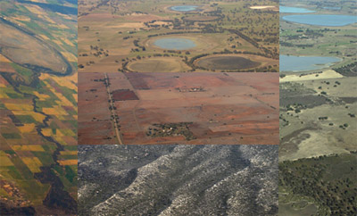 |  Geomorphology Reference Group field investigation near Mt Arapiles. |
© State of Victoria (Agriculture Victoria) 1996 - 2025.

This work, Victorian Resources Online, is licensed under a Creative Commons Attribution 4.0 licence. You are free to re-use the work under that licence, on the condition that you credit the State of Victoria (Agriculture Victoria) as author, indicate if changes were made and comply with the other licence terms.
The licence does not apply to ‘branding’ or some ‘images or photographs’ that may be owned by third parties. We ask you to seek prior approval to use images using the VRO feedback form. Access to higher quality images can also be provided on request.
This page was last updated on 25/01/2019.