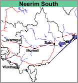
Neerim South (Ns)
|
Landform |  |
The soils of this mapping unit are essentially the same as those mapped by Sargeant (1975) as the Flinders Clay Association. Due to its distribution in the Warrgul-Moe region, it was decided to map these soils as the Neerim South mapping unit.
Most of the soils have dark grey light or medium clay surfaces, grading into yellowish grey mottled with yellowish brown medium or heavy clay subsoils. The underlying basalt is frequently encountered before 2 metres which suggests that these soils have had their original topsoil eroded in the geologic past. Small areas with brownish-grey clay loam surface soils occur where the underlying basalt is generally deeper.
This mapping unit forms a small part of the present map and the soils have not been sampled.


