11. Toorongo River
This information has been developed from the publications:
|
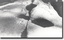
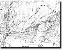
| Location: | 156100 to 161110. Toorongo River six kilometres north-east of Noojee. |  Potholes in river channel - Toorongo Falls. |
Access: | Toorongo Falls Road. | |
Ownership: | Crown Land. | |
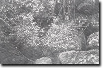
Geology/Geomorphology: | Medium grained, hornblende rich Toorongo Granodiorite is exposed in several waterfalls in the Toorongo River and its tributary draining the western slopes of Mount Toorongo. Above and below the falls the Toorongo River flows undergound for sections up to 100 metres in length. This appears to have resulted from the removal of parts of the fine matrix by the river after ancient landslides partially filled the river channel. | |
| Significance: | Regional. The waterfalls associated with the granodiorite metamorphic aureole contact, are the largest in the Central Gippsland Region. The nature of the Toorongo River channel is of additional significance as it may provide information on geomorphological processes which could elucidate the formation of the granite caves at Labertouche, (Site 8021 – 1). | |
| Management: | Landuse which would obscure or remove the features noted above should be prohibited. Reservoir construction or large scale quarrying in the area should be prohibited. | |
 Granodiorite boulders in Toorongo River valley. (River flows underground in this section). |


