Soil and Landscape Visualisations
| North Central CMA Soil and Landscape Assessment in the Upper Bet Bet Creek Catchment. | ||||
| This project was undertaken near Lexton in the lower catchment, looking at salt sources that feed into the Murray River System. The Upper Bet Bet Creek catchment in north-central Victoria is an erosional upland landscape (formed on Palaeozoic metasediments) typified by a high degree of variability in the nature and distribution of soil/regolith materials, landform evolution and salt stores. | Screen shot taken from the landscape panorama of the upper Bet Bet Creek catchment. |
| West Gippsland CMA Four visualisations have been produced to show the different terrace sequences in the Greater Latrobe River Valley catchment. The complexity of terrace sequences in this area is a unique feature of landscapes in Victoria. | ||||
1) An Interactive Landscape Visualisation in Coongulla Mapping Unit Coongulla Soil Landform Unit: This represents the oldest of the terrace sequence in West Gippsland. Soil types are texture contrast, often sodic (drier areas). Lateritic material.
| 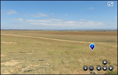 Screen shot taken from Interactive Landscape Visualisation in Coongulla Mapping Unit. | |||
| 2) An Interactive Landscape Visualisation in Briagolong Mapping Unit
Briagolong Soil Landform Unit: This represents the mid age of the terrace sequence in West Gippsland. Soil types are texture contrast, often sodic.
| 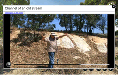 Screen shot taken from Interactive Landscape Visualisation in Briagolong Mapping Unit. |
| 3) An Interactive Landscape Visualisation in Tinamba Mapping Unit
Tinamba Soil Landform Unit: This represents the second youngest age of the terrace sequence in West Gippsland. Soil types are gradational, occasionally texture contrast and are reddish in colour. | 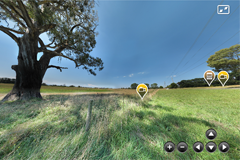 An Interactive Landscape Visualisation in Tinamba Mapping Unit. |
| 4) An Interactive Landscape Visualisation in Newry Mapping Unit Newry Soil Landform Unit: This represents the youngest age of the terrace sequence in West Gippsland. Soil types are gradational or uniform in profile, dark in colour and used for more intensive agricultural activities. | 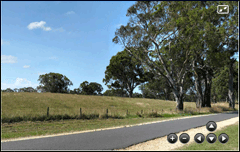 Screen shot taken from Interactive Landscape Visualisation in Newry Mapping Unit. |
| Mallee CMA
The Mallee Research Farm at Walpeup has been responsible for providing information for regional agricultural activities. High sand and calcium content are features of the soils here. | ||||
| Long Term Comparison of Rotation and Fallow Management Practices in the Victorian Mallee.
The MC14 experiment was established in 1985 to compare the long term effects of rotation and fallow management on wheat production in the Mallee. | Screen shot taken from of the 'MC14' panorama. |
| Mallee Manurial No.1 The Mallee Manurial No.1 (MM1) experiment was established in 1943 to determine the long term effect of superphosphate on wheat yield response in the Mallee. This site is not currently active. | Screen shot taken of the 'MM1' trial site panorama. |
| Wimmera CMA
The Longerenong area provides the landscape for a number of long-term cropping research and education activities, including more recent overt options for variable climate scenarios. | ||||
| Sustainable Cropping Rotations in Mediterranean Environments (SCRIME) This experimental site has been used primarily as a resource for postgraduate students within collaborative projects, where it provides a known history of management and rotation treatment. This landscape is a key landscape for cereal production research and further education. The soils are predominantly uniform grey (occasionally red) clay soils, generally cracking when dry. | Screen shot taken from a panorama of the SCRIME trial site. | |||
| National Adaptation and Mitigation Initiative (NAMI) A landscape visualisation of the NAMI experimental site at Longerenong. This site is not currently active. | 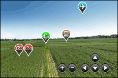 Screen shot from a landscape visualisation of the NAMI experimental site at Longerenong. |
| Glenelg Hopkins CMA
This landscape is an example of South West Victoria that specialises in pasture production, mainly for sheep rearing (meat and wool). Soil types are texture contrast, non-sodic. | ||||
| The Long Term Phosphate Experiment (LTPE) at the Hamilton Research Farm was established in 1977 at Hamilton as a short term site to demonstrate the potential carrying capacity of improved pasture with increased phosphorus. The experiment evolved into a long term monitoring site for assessing wool quality and soil constraints such as acidification and compaction. This site is not currently active. | Screen shot taken of the 'LTPE' panorama. |


