
3.2.3 Basaltic residuals (Warragul, Red Hill)
3. Southern Uplands (SU)
3.2 Low relief (low elevation, about 100 - 250 m)
| Both these areas represent residuals of the extensive basalt flows of the Older Volcanics that occurred during the Palaeogene. At Red Hill, the basalt residual above about 100 m is continuous and covers an area of about 100 square kilometres. It forms a broad plateau that gradually slopes towards the south-west; from about 200 m to 100 m. The landform is described as undulating to rolling low hills, with broad rounded crests and narrow open depressions terminated by prominent cliffs at Bass Strait. The relief is generally about 40 to 60 m with slopes generally less than 10%. In both areas the predominant drainage pattern is integrated and flows toward the south-east. The basalt residuals around Warragul cover an area of about 300 square kilometres form the north-central part of the low elevation plateau that extends from near Grantville to just south of Nerrim South (see 3.2.1). In general, the landform is more subdued than that at Red Hill and is described as undulating low hills with rounded crests, flats and open depressions. These flats generally can to be shown on a 1:100 000 map, and are often described as swamps. Annual rainfall around Red Hill is over 700 mm whereas around Warragul it exceeds 1 000 mm This is reflected in the original vegetation: Damp Forest around Warragul and Lowland Forest and Herb-rich Woodland forest around Red Hill. All of the soils developed on basalts here are deep red friable gradational soil (Ferrosols) and almost all have been cleared for intensive agriculture. Landslips are occur on slopes exceeding 10 degrees, but these are relatively uncommon compared to the soils on basalt around Thorpdale. | 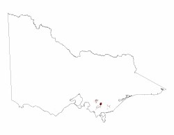 |
© State of Victoria (Agriculture Victoria) 1996 - .

This work, Victorian Resources Online, is licensed under a Creative Commons Attribution 4.0 licence. You are free to re-use the work under that licence, on the condition that you credit the State of Victoria (Agriculture Victoria) as author, indicate if changes were made and comply with the other licence terms.
The licence does not apply to ‘branding’ or some ‘images or photographs’ that may be owned by third parties. We ask you to seek prior approval to use images using the VRO feedback form. Access to higher quality images can also be provided on request.
This page was last updated on .