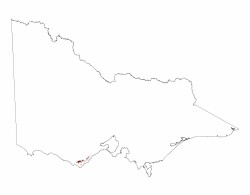
3.1.1 Plateaux and broad ridges (Beech Forest, Wyelangata, Balook)
3. Southern Uplands (SU)
3.1 High relief, (moderate elevation, about 250 - 600 m) Otway, Strzelecki and Hoddle Ranges
| West of Port Phillip Bay (Beech Forest, Wyelangata) The crest of the Otway Ranges has relatively low relief, reflecting the initial flat-topped structural block before recent uplift. This moderately dissected plateau forms a drainage divide which trends north-east from Moonlight Head through Lavers Hill to Mount Chapple (550 m), then easterly to Mount Sabine (583 m), and north-east to parallel the coast through the highest point at Mount Cowley (686 m) to Anglesea. The plateau has been delineated into two landsystems by Pitt (1981): the Beech Forest Landsystem, a rolling plain with rounded hills and shallow valleys; and the Mount Sabine Landsystem, disconnected remnants of an undulating plain. Both have moderately deep and fertile friable brown soils (Dermosols) developed on Cretaceous sedimentary rocks. Annual rainfall is high throughout the area, with most areas exceeding 1000 mm. Around the Beech Forest area the annual rainfall exceeds 1400 mm. Prior to European settlement the vegetation in the Otway Ranges was mostly wet forest, with areas of rainforest in the valleys. The area has been extensively logged and much is planted to softwood. Many areas of previously logged native forest are now protected and form part of the Otway National Park. |  |
East of Port Phillip Bay (Balook)
This area also has relatively low topography, reflecting the initially flat-topped structural blocks before recent uplift. The dissected Balook plateau forms a drainage divide that trends north-east following the Grand Ridge road from south of Balook to Willung South. Two other parts of the same plateau are north and west of Balook, one extending to Callignee, the other to Jeeralang North. The highest point on the Balook plateau is Mount Tassie (about 740 m). Most of the drainage to the south is via the Tarra River and its tributaries, to the east via Merriman’s Creek and to the north via Traralgon Creek.
The landform may be described as rolling hills with shallow valleys that become deeper valleys towards the plateau margins. Most of the surface soils are developed on Cretaceous sediments, but the plateau does have a discontinuous basalt cap (See 3.1.3). The soils developed on the Cretaceous sediments are moderately deep and fertile friable brown gradational soils (Dermosols) and are up to 2m deep.
Annual rainfall is high, generally above 1 000 mm and supported a wet forest, with areas of cool temperate rainforest in the valleys. Most is now used for plantation forestry, with a mix of softwood and hardwood plantations. Two small areas of National Park;Tarra Valley and Bulga include some of the Balook Plateau.


