Salinity Province 7, Bass
|
|
Province Attributes
| Catchment Management Region: | PORT PHILLIP & WESTERNPORT |
| Priority Status: | High |
| Province Area: | 10,380 ha |
| Recorded Soil Salinity Area 1: | 438 ha |
| Dominant Surface Geology Type: | Sedimentary |
| Influence of Geological Structure on Salinity Occurrence/s: | Probable |
| Relevant Geomorphological Mapping Units (GMUs): | 7.1.X, 3.3.X |
| Predominant Groundwater Flow Systems (GFSs): | Intermediate & Local/Intermediate |
| Relevant Irrigation Areas: | N/A |
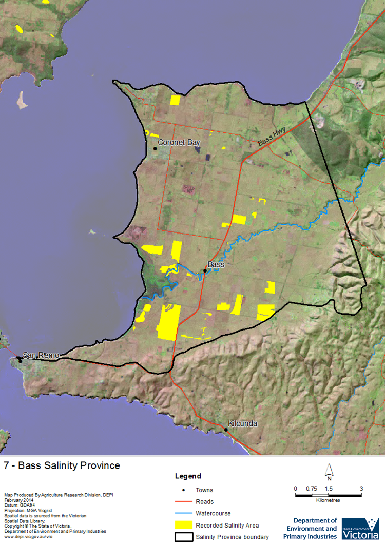
Bass Salinity Province Map

Links to further reading and material related to the Port Phillip and Westernport Salinity Province
Groundwater Flow Systems (GFS) in the Port Phillip & Westernport CMR
For further information relating to groundwater levels and salinities in this Province please see: Visualising Victoria's Groundwater (VVG)
1 Please Note: The ‘Recorded Soil Salinity Area’ indicated in the Salinity Province Attribute Table, comprises the total geographic area that has been mapped as having, or showing symptoms of, dryland soil salinity at some time (past or present). As dryland salinity occurrence in the Victorian landscape exhibits many different levels of severity and can change due to climate, landuse and vegetation, previously mapped areas may no longer be showing symptoms. In addition, as not all parts of the State have been mapped, or mapped in the same way, the mapping may not have captured some occurrences.
The soil salinity mapping used to calculate this ‘area’ does not cover irrigation regions. In irrigation regions, depth to watertable and watertable salinity mapping has been used to convey the threat of high watertables on soil waterlogging and/or soil salinisation and these areas are not included in this ‘area‘ calculation.
Please contact the Department, your Catchment Management Authority or your rural water provider for more information about salinity in your location.

 The Bass Salinity Province forms the western end of the Bass Peninsula on the southeast coast of Westernport Bay. Over half of the Province (its south and central areas) is alluvial low coastal plains (Bass River flood plain), while most of the remainder is slightly undulating (Lang Lang Lowlands) to the north, with a small section in the southeast forming the northern slopes of the South Gippsland Highlands (Strzelecki Group).
