Salinity Province 68, Macalister
|
|
Province Attributes
| Catchment Management Region: | WEST GIPPSLAND |
| Priority Status: | High |
| Province Area: | 117,400 ha |
| Recorded Soil Salinity Area 1: | 0 ha |
| Dominant Surface Geology Type: | Sedimentary |
| Influence of Geological Structure on Salinity Occurrence/s: | Possible |
| Relevant Geomorphological Mapping Units (GMUs): | 7.2.X, 7.3.X |
| Predominant Groundwater Flow Systems (GFSs): | Regional and Local/Intermediate |
| Relevant Irrigation Areas: | Macalister |
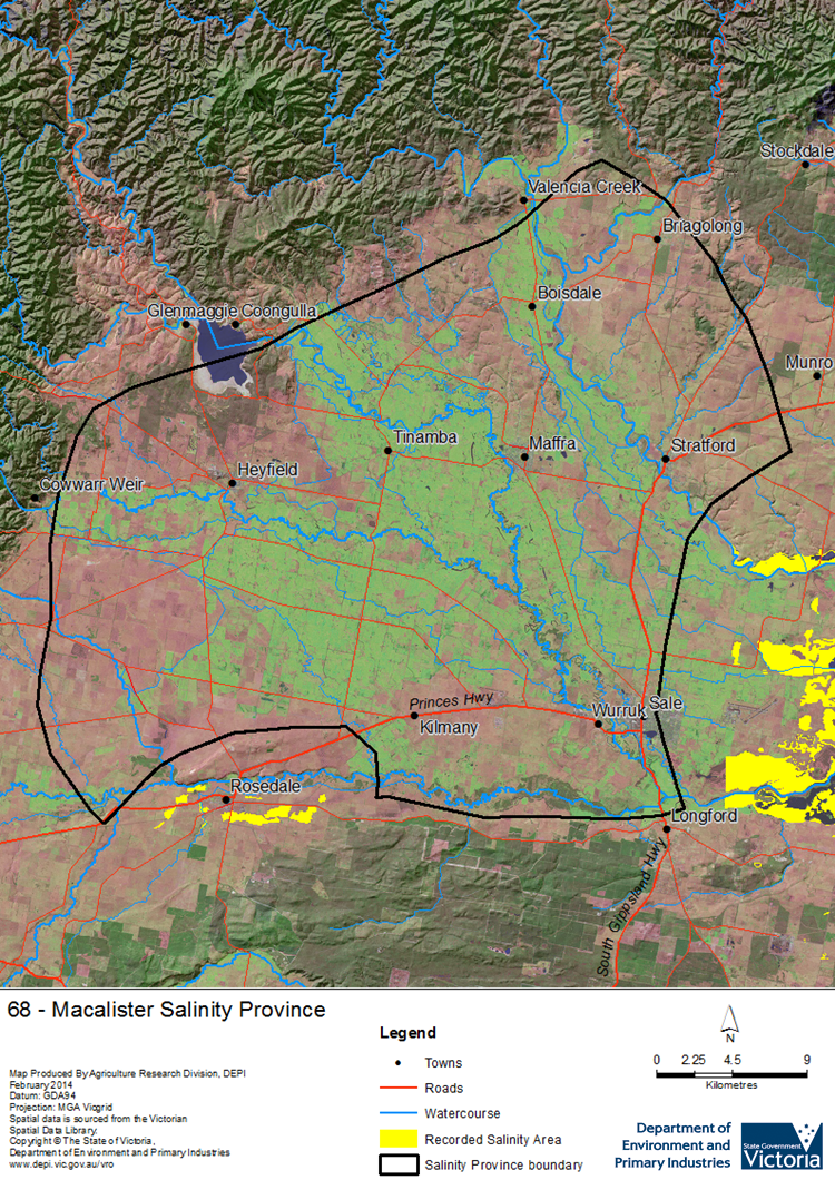
Macalister Salinity Province Map

Links to further reading and material related to the West Gippsland Salinity Province
Groundwater Flow Systems (GFS) in the West Gippsland CMR
For further information relating to groundwater levels and salinities in this Province please see: Visualising Victoria's Groundwater (VVG)
1 Please Note: The ‘Recorded Soil Salinity Area’ indicated in the Salinity Province Attribute Table, comprises the total geographic area that has been mapped as having, or showing symptoms of, dryland soil salinity at some time (past or present). As dryland salinity occurrence in the Victorian landscape exhibits many different levels of severity and can change due to climate, landuse and vegetation, previously mapped areas may no longer be showing symptoms. In addition, as not all parts of the State have been mapped, or mapped in the same way, the mapping may not have captured some occurrences.
The soil salinity mapping used to calculate this ‘area’ does not cover irrigation regions. In irrigation regions, depth to watertable and watertable salinity mapping has been used to convey the threat of high watertables on soil waterlogging and/or soil salinisation and these areas are not included in this ‘area‘ calculation.
Please contact the Department, your Catchment Management Authority or your rural water provider for more information about salinity in your location.

 Salinity in the large Macalister Salinity Province is mainly associated with irrigation induced high watertables and salinity of the Macalister Irrigation District. There is an underlying regional scale Groundwater Flow System (GFS) comprising alluvial sediments of the Seaspray - Sale group gravels overlain with a complex array of local to intermediate scale GFSs in younger alluvial sediments. Increased recharge due to irrigation and rainfall has resulted in high watertables, affecting farm productivity through soil damage and increasing salt and nutrient loads draining to the Gippsland Lakes.
