K6 Moonee Ponds Creek, Tullamarine - Older Volcanics
|
This information has been developed from the publications:
|
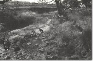
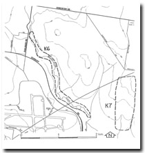
| Location | Keilor 105296. Shire of Bulla. Valley of Moonee Ponds Creek at western edge of Gellibrand Hill Park. |  K6 - Weathered Newer Volcanics and floodplain sediments, Gellibrand Hill. |
Access | Oaklands Road, Sunbury Road. | |
Ownership | Crown land | |
Site Description | The valley of the Moonee Ponds Creek includes outcrops of fresh and deeply weathered Older Volcanics Basalt. The channel is of varied form with short rocky sectors alternating with braided reaches where the channel is choked with granitic sands. The valley walls display excellent sections of fluvial deposited sands, silts and clays, and there are distinctive layers of water-worn cobbles of Older Basalt. Red Bluff Sands outcrop in places above Older Volcanics. | |
Significance | Regional This is one of the few unmodified sectors of the Moonee Ponds Creek in the metropolitan area. The outcrops of Older Volcanics are of particular interest as are the various channel deposits. These show aspects of the geomorphological history of Moonee Ponds Creek and complement the cultural interest of the Gellibrand Park. | |
Management | Class 2. There should be no artificial straightening or lining of the creek channel. The stream should be maintained in as a natural a condition as is consistent with the needs of park management. The geomorphological interest of the creek could be more prominently displayed in the official information pamphlets | |


