Mount Wilson
|
This information has been obtained from the report: Eruption Points of the Newer Volcanic Province of Victoria by Neville Rosengren. This report was published in 1994 and was prepared for the National Trust of Australia (Victoria) and the Geological Society of Australia (Victorian Division). The review of eruption points was based on an earlier unpublished manuscript Catalogue of the post-Miocene volcanoes of Victoria compiled by O P Singleton and E B Joyce (Geology Department, University of Melbourne 1970). |
| 37 27 00S 144 14 30E (external link); 7723-3-2 (Bullarto) 563524. 14 km SE of Daylesford. Mount Wilson Track. Lerderderg Road. |  Mount Wilson | |
Ballan. | ||
Public land (Lerderderg State Park). Forested. Outcrop. | ||
Type 4: | Lava hill. | |
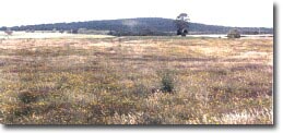
Mount Wilson is a steep isolated lava volcano resting on the Ordovician basement rocks of the Central Highlands. The volcano margins are eroded and defined by the Lerderderg River valley. The mountain has a broad dome-shape which contrasts with the steeper dissected terrain on Ordovician sedimentary rocks. The rocks are more silica-rich than the typical Newer Volcanics lavas and have affinities with the older lavas of the Mount Macedon area (Mount Eliza, Camels Hump). | ||
863 m; 90 m. | ||
Regional: | This is one of the most elevated eruption points in the Newer Volcanics Province. The an orthoclase trachyphonolite is an unusual rock type in this province. | |
References: | Mahony, D.J. (1931). Alkaline Tertiary rocks near Trentham and at Drouin, Victoria. Proceedings of the Royal Society of Victoria 43, pp. 123-129 Edwards, A. B. (1938). The Tertiary volcanic rocks of central Victoria. Quarterly Journal of the Geological Society of London 94, pp. 243-320. Coulson, A. (1954). The volcanic rocks of the Dayles ford district. Proceedings of the Royal Society of Victoria 65, pp. 113-124. | |

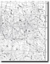
Mount Wilson 7723-3-2 (BULLARTO)


