Wheeler Hill
|
This information has been obtained from the report: Eruption Points of the Newer Volcanic Province of Victoria by Neville Rosengren. This report was published in 1994 and was prepared for the National Trust of Australia (Victoria) and the Geological Society of Australia (Victorian Division). The review of eruption points was based on an earlier unpublished manuscript Catalogue of the post-Miocene volcanoes of Victoria compiled by O P Singleton and E B Joyce (Geology Department, University of Melbourne 1970). |
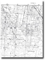
| 37 23 00S 144 11 30E (external link); 7723-3-2 (Bullarto) 512589. 5 km SE of Daylesford. Daylesford-Trentham Road. |  Wheeler Hill | |
Daylesford and Glenlyon. | ||
Private land. Grazed and cropped, large planted windbreaks, outcrop in road cutting shows scoria and bombs. | ||
Type 9: | Composite lava and scoria volcano | |
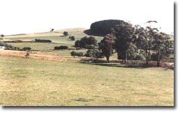
Wheeler Hill is a large composite volcano being a well-defined scoria cone with a crater open towards the northwest and lava flows to the north contributing to the Deadmans lead at Daylesford. A small summit flow has been analysed as limburgite - a dense ultrabasic lava consisting of olivine and augite. Cuttings on Wheeler Hill Road expose pyroclastic deposits and lava bombs. | ||
791 m; 75 m. | ||
Regional: | This is a good example of limburgite which is an uncommon rock in the Newer Volcanics Province. This is also one of the few exposures of pyroclastic rock in the Central Highlands. | |
References: | Coulson, A. (1954). The volcanic rocks of the Daylesford district. Proceedings of the Royal Society of Victoria 65, pp. 113-124. | |

Wheeler Hill 7723-3-2 (BULLARTO)


