Kangaroo Hill (Denver)
|
This information has been obtained from the report: Eruption Points of the Newer Volcanic Province of Victoria by Neville Rosengren. This report was published in 1994 and was prepared for the National Trust of Australia (Victoria) and the Geological Society of Australia (Victorian Division). The review of eruption points was based on an earlier unpublished manuscript Catalogue of the post-Miocene volcanoes of Victoria compiled by O P Singleton and E B Joyce (Geology Department, University of Melbourne 1970). |
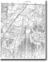
| 37 16 30S 144 18 00E (external link); 7723-2-4 (Coliban) 611716. 11 km SW of Malmsbury. |  Kangaroo Hill | |
Daylesford-Malmsbury Road. | ||
Daylesford and Glenlyon. | ||
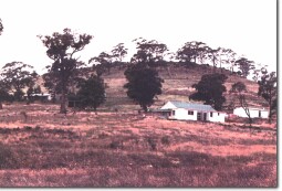
Private land. Grazing, few trees on top, outcrop at summit. | ||
Type 4: | Lava hill. | |
The flat-topped lava mound has a summit bounded by basalt escarpments. Lava from this vent followed the ancestral Coliban River forming the Kangaroo Hill deep lead. The base of the flow is exposed at many localities along the present Coliban valley near Malmsbury and Taradale. | ||
658 m; 75 m. | ||
Regional: | An example of a very large deep lead flow eruption point. | |
| References: | Edwards, A. B. (1938). The Tertiary volcanic rocks of central Victoria. Quarterly Journal of the Geological Society of London 94, pp. 243-320. Coulson, A. (1954). The volcanic rocks of the Daylesford district. Proceedings of the Royal Society of Victoria 65, pp. 113-124. | |

Kangaroo Hill 7723-2-4 (COLIBAN)


